

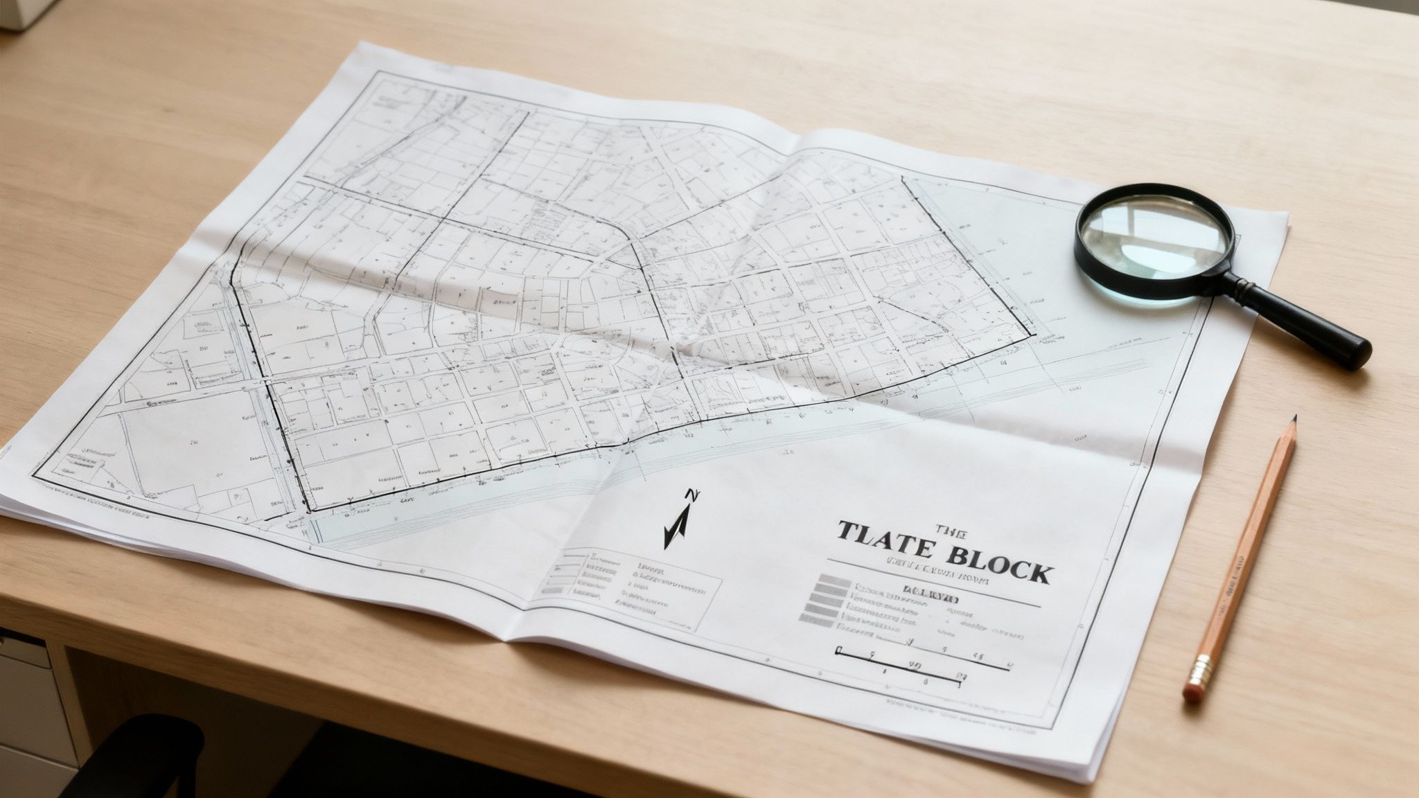
When you first lay eyes on a plat map, it can feel a little intimidating. All those lines, symbols, and numbers can look like a foreign language. But for professionals in title, land development, and energy, mastering this language isn't just a skill—it's a necessity. Misinterpreting a single detail can lead to costly delays, legal disputes, and derailed projects.
The key to avoiding these pitfalls is to approach each map systematically. Before you dive into individual property lines, take a moment to get the lay of the land. A quick, strategic scan gives you the context needed to make sense of the critical details that follow.
Your First Glance at a Plat Map
Think of this first look as establishing your project's anchor point. It’s about getting your bearings so you can navigate the rest of the document with the precision your work demands.
To help you get started, here's a quick rundown of the essential elements you must locate first to establish a baseline for your analysis.
Key Plat Map Elements at a Glance
| Component | What It Is | Why It's Critical for Professionals |
|---|---|---|
| Title Block | The map's "ID card," usually in a corner. | Provides the official subdivision name, location, surveyor, and recording dates needed for chain of title. |
| Legend (or Key) | Your decoder ring for all symbols. | Explains what every line type, abbreviation, and symbol on the map legally means for that specific document. |
| North Arrow | A simple graphic pointing North. | Shows the map's physical orientation, which is crucial for development planning and site analysis. |
| Scale | The ratio of map distance to real-world distance. | Translates the drawing into actual measurements (e.g., 1" = 100'), essential for verifying dimensions. |
Let's break down exactly what you're looking for in each of these areas.
Finding Your Bearings
Your first stop should always be the title block. It’s usually boxed off in a corner and contains all the high-level identifying information you need:
- Subdivision Name: The official name of the project, like "Whispering Pines, Section 3."
- Location Information: This pins the property down to its specific section, township, range, county, and state.
- Surveyor Details: The name and license number of the professional surveyor or firm that created the map.
- Approval and Recording Dates: Key dates that show when the plat was officially approved and filed in the public record.
Right near the title block, you'll almost always find the legend, or key. This is your decoder for the entire document. It translates every symbol, abbreviation, and line type into plain English. A dashed line could be a utility easement, a future road, or a setback—you won’t know for sure without checking the legend first.
Pro Tip: I can't stress this enough: always check the legend first. A common mistake is assuming a symbol from one plat map means the same thing on another. Different surveyors and jurisdictions have their own shorthand, so verifying is non-negotiable for maintaining accuracy.
Understanding Scale and Direction
Next up, locate the north arrow and the scale. The north arrow is a simple but vital graphic that points toward geographic north. This immediately tells you how the properties are situated on the ground, impacting everything from solar access for development to asset placement for energy projects.
The scale (e.g., 1" = 100') is what turns the drawing into a real-world tool. It's the ratio that translates distances on paper into actual feet. With the scale in mind, you can start to visually estimate the size of lots, the width of roads, or the length of a property line just by looking at it.
Getting this right is a fundamental skill. These maps are legally binding documents, and their accuracy is paramount. In fact, property boundary conflicts account for nearly 20% of all real estate litigation in the U.S.
For large-scale projects, trying to interpret and extract data from hundreds of these documents manually is a massive undertaking. It's exactly why modern land and energy developers are turning to specialized tools to automate the process, ensuring nothing gets missed. You can find more information about these tools for developers.
Decoding the Language of Lines and Numbers

Alright, you've got the title block and legend sorted out. Now comes the real meat of the map—that dense web of lines, numbers, and cryptic codes that actually define the property. This is where a parcel's legal identity truly takes shape. Learning to read these details is like translating a specialized language into a clear picture of the property's boundaries, size, and orientation.
These aren't just abstract figures; they are the legally binding descriptions that underpin ownership and development rights. Getting this part right is absolutely fundamental to your project's success.
Tracing the Boundaries with Lot Lines
Your eyes will naturally be drawn to the lot lines first. These are almost always solid, bold lines that create a polygon, mapping out the exact legal perimeter of a piece of land. Think of them as a property fence, but with far more legal weight behind them.
It's critical to distinguish these from other lines you might see. Dashed lines often represent easements, while lighter lines might show topographical features. This is why you always cross-reference with the legend you found earlier—it confirms what every line style actually means.
One interesting thing you might spot is a "tie line," which often looks like a curved or bracketed line connecting two separate lots. This is a shorthand to show that both lots are assessed as a single parcel for tax purposes, even though they have their own distinct lot numbers.
Interpreting Dimensions and Distances
Look closely at each lot line, and you'll see a number right next to it. That's the dimension, telling you the length of that specific boundary, almost always measured in feet. If a line has "150.00'" next to it, you know that side of the property is precisely 150.00 feet long.
These numbers are exact for a good reason. They let you calculate the lot's total area and double-check that it lines up with the legal description in the deed. Sometimes surveyors use hash marks or quotation marks as a shortcut, indicating a dimension is the same as an adjacent or parallel line. It's a simple way to keep the map from getting too cluttered.
A tiny mistake in these dimensions can snowball into a massive problem. Misreading just a few feet can lead to expensive construction mistakes, ugly encroachment disputes with neighbors, or even legal challenges to the property's title.
Imagine trying to manually verify every single dimension across dozens of plats for a big project. It's not just a headache; it's a huge risk for human error. This is where automated data extraction tools are a game-changer. A platform like TitleTrackr can pull these critical dimensions from scanned documents in seconds, flagging any inconsistencies and guaranteeing accuracy without the manual grind.
Understanding Surveyor Bearings
This is where things can look a bit intimidating, but the concept is actually pretty straightforward. Along with its length, each boundary line has a bearing. This is a combination of letters and numbers that looks something like N 89° 15' 22" E.
Let's break that down piece by piece:
- First Letter (N or S): This tells you if the line's direction starts by pointing North or South.
- Angle (e.g., 89° 15' 22"): This is the precise angle in degrees (°), minutes ('), and seconds (") that the line veers away from true North or South.
- Second Letter (E or W): This shows the direction of that angle—either East or West.
So, a bearing of N 89° E describes a line that starts by facing North, then turns almost 89 degrees toward the East. It's an incredibly precise way to define the exact direction of each boundary, ensuring another surveyor could recreate the property perfectly on the ground years from now.
These bearings and distances are two sides of the same coin. Together, they create what's known as a "metes and bounds" description—a narrative that essentially walks you around the property: "Start at this point, go in this exact direction for this exact distance, then turn…" This sequence creates a legally airtight, unambiguous definition of the property's perimeter. Trying to piece this puzzle together by hand demands intense focus, because a single mistake can throw the entire boundary off.
Uncovering Hidden Easements and Rights of Way
A plat map does more than just draw the lines of what you own; it also tells you what rights other people have to use parts of your property. These are called easements and rights-of-way, and they’re a classic blind spot for even seasoned professionals. Missing one is one of the most common—and costly—mistakes you can make.
Think of them as hidden restrictions that can completely change your plans. They dictate where you can build, what you can plant, and where you can put up a fence.
An easement is basically a legal permission slip. It lets someone else, like the power company or your next-door neighbor, use a specific part of your land for a specific reason. They don't own it, but they have a legally protected right to be there, and that right can throw a major wrench in your development plans. These crucial details are usually tucked away in the map's fine print.
Identifying Common Types of Easements
Before you can find them on a map, you need to know what you’re looking for. There are a handful of common easements that show up again and again, each with a different job.
You'll almost certainly run into these:
- Utility Easements: By far the most common. They give utility companies the right to run and maintain lines for power, water, sewer, and internet.
- Access Easements: These grant a neighbor the right to cross your property to get to theirs. Think shared driveways or a landlocked parcel behind yours.
- Drainage Easements: These areas are set aside to handle water flow, making sure runoff has a clear path to prevent flooding.
- Conservation Easements: These are designed to protect something special—like a scenic view or natural habitat—by restricting development on that part of the property.
Each one has its own set of rules, so figuring out which type you’re dealing with is the first critical step.
Spotting the Visual Clues on the Map
Easements are rarely spelled out in big, bold letters. Surveyors use a kind of visual shorthand to mark them. The first thing to look for is a dashed or dotted line cutting across a lot or running along a boundary. Unlike the solid lines marking the property itself, these different line types are an immediate red flag that a special condition exists.
To figure out what that condition is, you’ll need to hunt for nearby text or abbreviations. You might see a note like "10' U.E." which means there’s a ten-foot-wide utility easement. Or, the text might be right inside the dashed lines, saying something like "Drainage & Storm Sewer Easement." The legend is your Rosetta Stone here—it will define what every line type and abbreviation on that specific map means.
Misinterpreting an easement isn't just a minor hiccup; it can be a project-killer. I've seen developers plan a whole building addition, only to discover a wide, no-build drainage easement running exactly where the foundation was supposed to go. The project screeched to a halt, forcing a complete and costly redesign.
This is exactly the kind of critical detail that can slip through the cracks during a manual review. For professionals doing complex title work, accuracy is non-negotiable. Having the right resources is key, and there's excellent information available for title abstractors and researchers looking to sharpen these skills.
To help you get started, here’s a quick reference table for some of the symbols you'll see most often.
Common Plat Map Symbols and Their Meanings
This table is a great cheat sheet for deciphering the most common abbreviations, symbols, and line types you'll find on a plat map.
| Symbol / Abbreviation | What It Means | Common Application |
|---|---|---|
| P.O.B. | Point of Beginning | The starting reference point for the property's legal description. |
| U.E. | Utility Easement | Marks an area for power, water, sewer, or communication lines. |
| D.E. | Drainage Easement | Indicates a path for water runoff that must remain clear. |
| S.S.E. | Sanitary Sewer Easement | Specifically for underground sewer lines and access. |
| R/W or ROW | Right-of-Way | Designates a path for public or private access, like a road. |
| B.L. | Building Line or Setback Line | The line where permanent structures cannot be built past. |
| (dashed line) | — | Often used to show an easement or other non-boundary line. |
| (solid line) | ― | The official property or lot boundary line. |
While this covers the basics, always remember to check the map's legend, as symbols can vary slightly from one surveyor to another.
A Real-World Scenario: The Drainage Ditch Dilemma
Let’s walk through a real-world example. Imagine you’re looking at a commercial lot for a new coffee shop. The plat map seems perfect—great road access, clean boundaries. But then you spot a faint dashed line cutting across the back corner, with "20' D.E." printed in tiny text next to it.
A quick look at the legend confirms your suspicion: it's a 20-foot drainage easement. What does that actually mean? It means a 20-foot-wide strip of your property must be kept completely clear to manage water. You can’t build on it, pave it over for parking, or even landscape it in a way that blocks the flow.
Suddenly, the available space to build on just shrank. That loading dock you planned for the back of the building? It's now sitting right in the middle of the easement, which is a non-starter.
If you had missed that little note, you could have broken ground, only to get hit with a stop-work order from the county and a legal mess. That one dashed line completely changed the property's value and potential. This is why learning to spot these subtle but powerful details isn't just a good idea—it's an essential skill for protecting your projects and investments.
Getting Hands-On With a Real Plat Map
Knowing the definitions is one thing, but the real learning happens when you put that knowledge to work. Let's walk through a sample plat map for a residential subdivision, just like one you'd see in the real world. This is the best way to see how all those lines and symbols come together to tell a property's complete story.
We'll start with the big picture, getting our bearings on the map itself. Then, we’ll zoom in on a single lot to dissect its specific details. Think of this as building a repeatable skill—turning abstract concepts into practical confidence for the next plat map that lands on your desk.
First, Get Your Bearings
Before you even think about looking at a specific parcel, you have to orient yourself. It's the most important first step. Find the title block, which is usually tucked into a corner. On a map for "Oakwood Estates, Phase II," for instance, you'd see the official name, the surveyor's details, county recording info like Book 123, Page 45, and the survey date.
Next, find the legend. This is your decoder ring. A solid line might mean "Lot Line," while a dashed line indicates a "Utility Easement (U.E.)." Skipping this is like trying to read a map without knowing what the symbols mean—you see the shapes, but the meaning is lost.
Finally, spot the North arrow to understand the property’s orientation and the scale (e.g., 1" = 50') to translate the drawing into real-world distances. With these three elements handled, you've got the context you need to dive into an individual lot.
Analyzing a Specific Lot
Okay, let's zoom in on a single property, "Lot 24." This is where we trace the perimeter and pin down its exact attributes.
- Follow the Lot Lines: The solid lines show us Lot 24 is a clean rectangle. The map clearly labels the dimensions on each side. The front and back boundaries are marked as 80.00', and the side boundaries are 125.00'. These aren't estimates; they're the legal lengths of the property lines.
- Read the Bearings: Right alongside each dimension, you'll see the surveyor's bearings. The front line might read S 89°30'00" W, telling you it runs almost perfectly east-west. The side lines would have bearings defining the property's precise north-south angle.
- Find the Lot and Block Numbers: Smack in the middle of the parcel, you'll see the number 24. That’s the lot number. Often, you'll see a larger block number that covers a group of lots, which helps keep the whole subdivision organized.
This trio—lot lines, dimensions, and bearings—creates the legally recognized footprint of the property. Every detail here is critical. Even a tiny discrepancy can snowball into major legal and financial headaches down the road.
Spotting Easements and Other Red Flags
Once you've got the basic geometry down, your next move is to scan for any restrictions. Look closely at Lot 24. See that dashed line running along the entire back of the property? A quick check of the legend confirms it's a "10' Utility Easement (U.E.)."
This is a classic "gotcha" moment. Many people miss these.
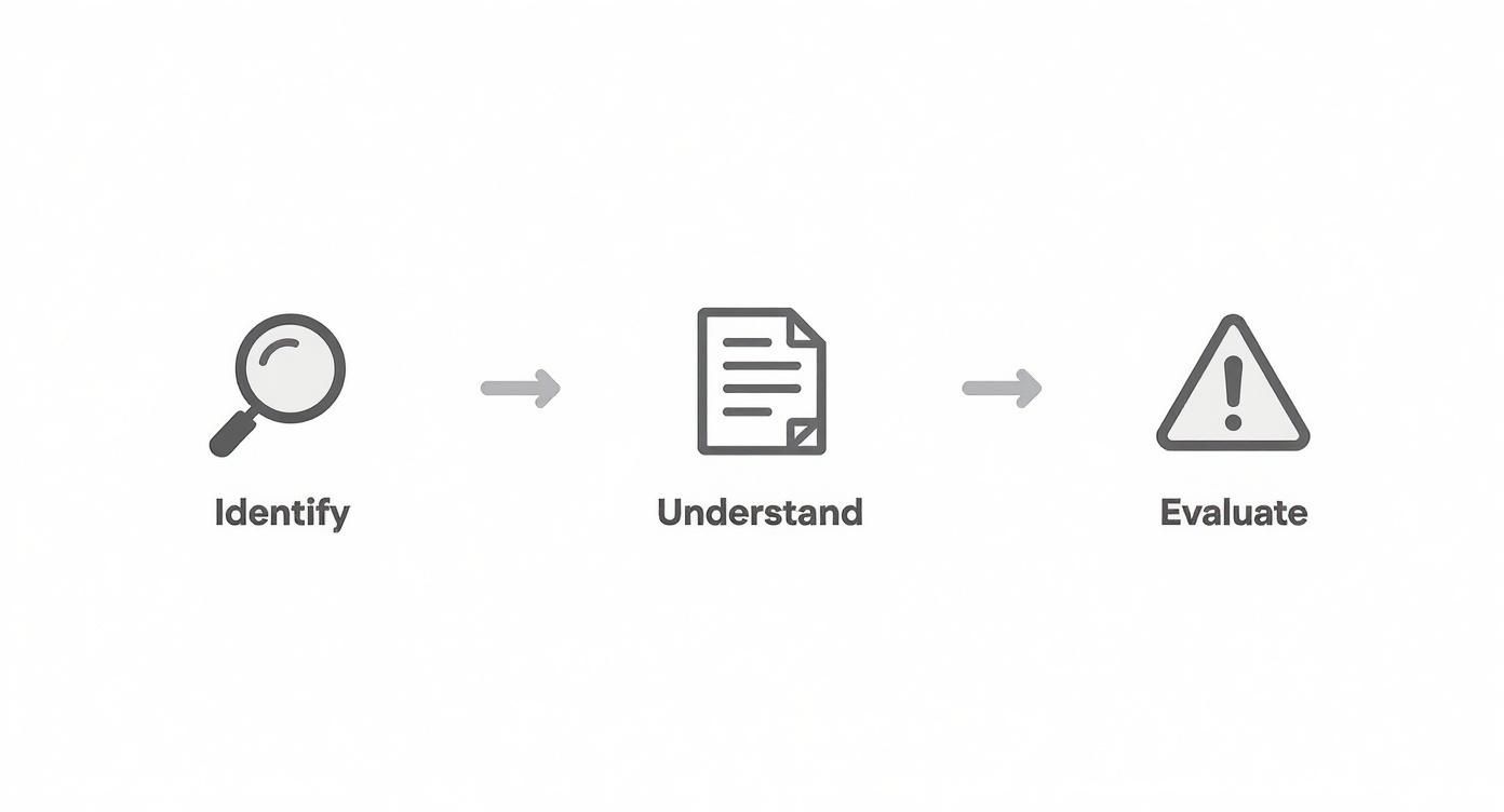
As the infographic shows, just finding an easement isn't enough. You have to understand what it's for and what it means for the property owner.
In this case, it means a 10-foot-wide strip along the back of the lot is off-limits for permanent structures. No sheds, no pools, no decks.
A future homeowner could sink thousands into a backyard project, only to be legally forced to tear it all down. For a developer, missing an easement that cuts across multiple lots could derail an entire construction plan, causing expensive delays and redesigns.
This walkthrough shows you how to systematically break down a plat map, moving from a high-level view down to the nitty-gritty details of a single lot. It’s a process of identifying, interpreting, and connecting the dots.
Doing this analysis manually for hundreds of properties is tedious and wide open to human error. One missed easement or a single misread dimension can lead to a disaster. That's why professionals in title, energy, and land development are turning to automated solutions. A platform like TitleTrackr can analyze these documents in moments, pulling out every dimension, bearing, and easement with precision and flagging potential issues before they become expensive problems. To see how it works, you can request a personalized demo of TitleTrackr.
Using Modern Tools for Plat Map Analysis
The days of poring over a dusty, oversized paper map with a magnifying glass are over. While knowing how to manually interpret a plat map is a foundational skill, the reality is that the industry has moved on to a far more efficient and accurate digital approach. Land records are now overwhelmingly online, integrated into powerful Geographic Information Systems (GIS) that have completely changed how we interact with property data.
This isn't just a matter of convenience; it’s a fundamental leap forward in how we understand and manage land. Digital records give us instant access, eliminate the need for massive physical storage, and deliver a level of accuracy that slashes the risk of expensive human errors.
The Digital Transformation of Land Records
Most county recorder or clerk offices now run online portals where you can find and download digital plat maps in seconds. This is a massive improvement over the old, time-consuming trips to a government office. But a scanned PDF is still just a static image. The real breakthrough is the software that can actually read and interpret these documents for you.
This global push toward digital plat maps is all about driving efficiency and legal certainty in property deals. In the U.S., for instance, over 70% of county governments had adopted digital plat maps by 2023 to improve how they manage land. Yet, it’s a different story in many developing regions, where only about 30% of land is officially mapped, a fact that can seriously slow down economic growth. To see the bigger picture on this, you can explore the full data on global development metrics.
From Manual Scrutiny to Automated Insight
Instead of manually tracing lines and typing out dimensions one by one, professionals now use AI-powered tools that treat a plat map like a rich, structured dataset. This technology goes way beyond simple viewing—it actively analyzes the document to pull out the critical information you need.
Here’s how it works in the real world:
- Automated Data Extraction: The software scans the map and automatically pulls out key data points like lot numbers, dimensions, bearings, and easement descriptions.
- Issue Flagging: It can spot potential red flags that the human eye might miss during a tedious review, like conflicting measurements or missing information.
- Interactive Visualization: The data is often laid out on an interactive map, letting you click on a parcel and see all its associated details instantly.
This screenshot from TitleTrackr gives you a good idea of what I'm talking about. It's an AI-powered dashboard that visually organizes the extracted plat map data, making incredibly complex information scannable and actionable at a glance.
The platform turns a flat document into a dynamic, interactive workspace where you can verify property details and analyze land records with far greater speed.
This isn't about replacing professional expertise; it's about amplifying it. These tools handle the repetitive, high-volume work, freeing up experts to focus on analysis, strategy, and resolving complex title issues.
Advanced platforms like TitleTrackr are leading this charge. By using AI agents trained specifically on land and legal documents, the system can read a plat map, generate a professional report, and flag potential risks in a matter of seconds. For a land developer analyzing a potential acquisition or a title abstractor working through a complex chain of title, this can slash workflow times by up to 90%.
The result isn’t just faster work—it’s safer, more reliable work. By automating the extraction and verification process, you dramatically lower the risk of errors that could snowball into costly legal disputes down the line. To see how this technology can be applied to your specific workflow, you can request a demo of TitleTrackr.
Common Questions About Reading Plat Maps
Even after you've got a handle on the basics, plat maps have a way of throwing curveballs. You're in the middle of a project, and suddenly a specific detail just doesn't add up. It’s completely normal—these documents are packed with dense legal and technical jargon.
Let's walk through some of the most common questions that pop up in the field. Think of this as your go-to guide for those tricky situations that can bring your workflow to a grinding halt. Getting these answers right is what separates a novice from an expert.
Plat Map vs. Survey: What’s the Difference?
This one comes up all the time. A plat map and a boundary survey are cousins, but they absolutely do not serve the same purpose.
A plat map is the blueprint for an entire subdivision or neighborhood. It’s the official, recorded document that shows how a huge piece of land was carved up into individual lots, streets, and common areas. It legally creates those parcels in the eyes of the county.
A boundary survey, on the other hand, is a close-up portrait of a single piece of property that already exists. A surveyor creates it to pinpoint that specific parcel’s exact boundaries, its dimensions, and any improvements like a house or fence. It will also call out any easements or encroachments found on that specific lot.
Key Takeaway: The plat map creates the whole neighborhood; the survey details one specific piece of it. You use the plat for the big picture and the survey to verify the nitty-gritty details of an individual property.
Where Can I Find the Official Plat Map?
Since these are official public records, the county government is your source. The office in charge of land documents is where you'll find them, though the name changes depending on where you are.
You'll typically be looking for the:
- County Recorder's Office
- Register of Deeds
- Clerk of Court
Luckily, many counties have gone digital, which is a massive time-saver. You can often search and download plat maps right from their websites. The quickest way to find what you're looking for is to search by the subdivision name, the property address, or the Parcel Identification Number (PIN). If you need to dig deeper, our team has put together more resources in our TitleTrackr FAQ section.
What if the Plat Map and Reality Don't Match?
It happens more often than you'd think. You might find a fence that’s clearly a few feet off from where the plat map says the property line should be. When you spot a discrepancy like this, you need to act on it immediately to head off a potential boundary dispute.
Your very first call should be to a licensed professional land surveyor. They will perform a field survey to establish the true boundary lines, using the recorded documents, legal principles, and any physical evidence they can find, like old property corner monuments. Their professional findings are what will hold up legally—not where someone decided to put a fence a few decades ago.
Can a Plat Map Be Changed?
Yes, but it's not a simple fix. Changing a recorded plat map is a formal, and often complicated, legal process. You can amend or even vacate (void) a plat through a procedure called a "replat" or "plat amendment."
This isn't something a homeowner can just do on a whim. It usually requires filing an application with the local planning or zoning department, commissioning a brand new survey, and getting formal approval from a governing body like the city council. It’s a serious undertaking most often used to combine two lots into one, adjust a boundary between neighbors, or change an easement. You'll almost certainly need surveyors and lawyers to get it done.
Trying to spot these issues by manually sifting through hundreds of documents is how costly mistakes are made. TitleTrackr uses AI to instantly pull and analyze data from plat maps, flagging discrepancies and uncovering critical details in seconds. Stop getting buried in the fine print and start making faster, better-informed decisions.

Leave a comment