

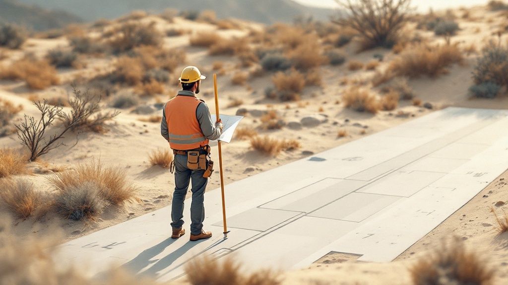
A boundary survey is the legally recognized map that defines the exact size, shape, and location of your property. Think of it as your land's official birth certificate—it establishes the definitive truth of your ownership rights and protects you from some very real, and very expensive, potential disputes. For industry professionals, it's the foundational document for any transaction, development, or title examination.
Defining Your Property’s Official Blueprint
It’s a common mistake to think the fence, hedge, or driveway you see every day marks the edge of a property. In reality, these features are often misplaced, sometimes by several feet, leading to confusion and conflict down the road. A boundary survey cuts right through that ambiguity, providing an undeniable record of a property's precise dimensions.
This crucial document is prepared by a licensed surveyor, a professional who acts as both a historical detective and a modern technician. They meticulously research public records, deeds, and past surveys before heading out with advanced tools like GPS to measure the land itself. The final product is a detailed map, or "plat," that stands as the legal authority on where a property begins and ends.
The Real-World Stakes of a Survey
Without a clear boundary survey, you're exposing your projects and clients to serious financial and legal risks. A simple disagreement can quickly spiral into an expensive conflict that derails timelines and budgets. For instance, a neighbor building a new fence just a few feet onto a property creates a major title defect that’s nearly impossible to resolve without a certified survey as hard evidence.
A boundary survey is more than just a map; it's a foundational risk management tool. It provides the legal clarity needed to secure title insurance, obtain mortgages, and prevent costly disputes before they even begin.
To give you a clearer picture, here’s a quick breakdown of what a boundary survey really does.
Boundary Survey at a Glance
This table summarizes the core components and outcomes of a boundary survey, giving you a quick reference to its key functions.
| Component | Purpose | Key Outcome |
|---|---|---|
| Historical Research | To review deeds, public records, and prior surveys for historical context. | Establishes the property's legal history and chain of title. |
| Field Measurements | To physically measure the property using modern surveying equipment. | Provides precise, real-world dimensions and corner locations. |
| Boundary Line Establishment | To mark and confirm the exact location of the property lines on the ground. | Creates physical markers (monuments) for clear identification. |
| Plat of Survey | To create a detailed map showing boundaries, dimensions, and improvements. | Delivers a legally defensible document of the property's layout. |
| Encroachment Identification | To identify any structures or features crossing property lines. | Flags potential legal issues with neighboring properties. |
As you can see, a survey isn't just about drawing lines; it's about creating a comprehensive, legally sound definition of a property that every stakeholder can rely on.
Why Every Property Owner Needs Clarity
A boundary survey isn't a one-time formality. It's an active asset that protects ownership rights indefinitely. It’s the key that unlocks several critical functions, providing both peace of mind and financial security.
Here’s why it’s so important:
- Resolving Disputes: It offers a legally binding resolution to disagreements over property lines, easements, or encroachments. No more he-said, she-said.
- Enabling Development: Before you can build a new structure, add an extension, or even put up a fence, a survey is often required to get the necessary building permits.
- Facilitating Transactions: When buying or selling property, a recent survey ensures everyone involved has accurate information, preventing future claims or legal challenges.
For those in land development, managing extensive property records is a core part of the job. You can learn more about how modern solutions support land and energy developers in organizing this critical information at http://titletrackr.com/developers. At the end of the day, a boundary survey is the non-negotiable starting point for secure property ownership.
Tracing Property Lines Through History
To really get why a modern boundary survey is so powerful, you have to look at where the idea came from. Defining and defending property lines isn't some new-fangled concept; it's a practice that goes back thousands of years, born from our basic human need for order and certainty over land. Long before GPS and digital maps, civilizations were already wrestling with this exact problem.
The practice is surprisingly ancient, with its roots stretching all the way back to ancient Egypt around 1400 B.C. Back then, surveyors called 'rope stretchers' used simple geometry to re-mark farm plots after the Nile River’s yearly floods washed everything away. This early version of what we now call a cadastral survey was essential for farming, taxes, and keeping the peace. It just goes to show that clear boundaries have always been the foundation of a working society.
This timeless need for clarity pushed the practice to evolve over the centuries as tools and techniques got better and better.
From Rope Stretchers to Gunter’s Chain
The methods obviously became more refined over time. A huge leap forward happened in 1620 with the invention of Gunter's Chain, a measuring tool that finally standardized survey measurements for legal and business use. This simple innovation made it possible to create consistent, legally-defensible property records—a critical step toward modern property law as we know it.
Fast forward to the 18th century, and you have prominent figures like George Washington out there as active boundary surveyors, helping map out huge chunks of land in the new American territories. Their work hammered home just how vital surveys were for land deals, settlement, and organizing a new nation. The historical context makes it clear: the core purpose of a boundary survey hasn't really changed at all.
While the technology has transformed from knotted ropes to satellite signals, the fundamental goal remains unchanged: to provide undeniable, legally recognized proof of a property's exact boundaries.
The Modern Connection to an Ancient Practice
Today’s surveyors blend deep historical deed research with high-tech gear, but their work is a direct line from this ancient tradition. They’re the modern-day rope stretchers, tasked with bringing clarity and order to who owns what.
A huge part of this process falls to the title abstractors, who dig through mountains of historical records to connect past deeds to present-day land. This link between old and new is why a survey isn't just a technical drawing; it’s a document deeply woven into the legal and historical fabric of property rights. When you understand that lineage, you get a much deeper appreciation for the weight and authority a professional boundary survey carries today.
How a Boundary Survey Actually Works
So, how does a boundary survey come together? It’s not a single, complicated event but a methodical process broken down into three clear phases. Think of it as a journey where each step builds on the last, turning dusty old records and high-tech measurements into a legally solid document that defines your property.
This infographic gives you a great visual of that flow, from digging through archives to the surveyor creating the final, certified map.
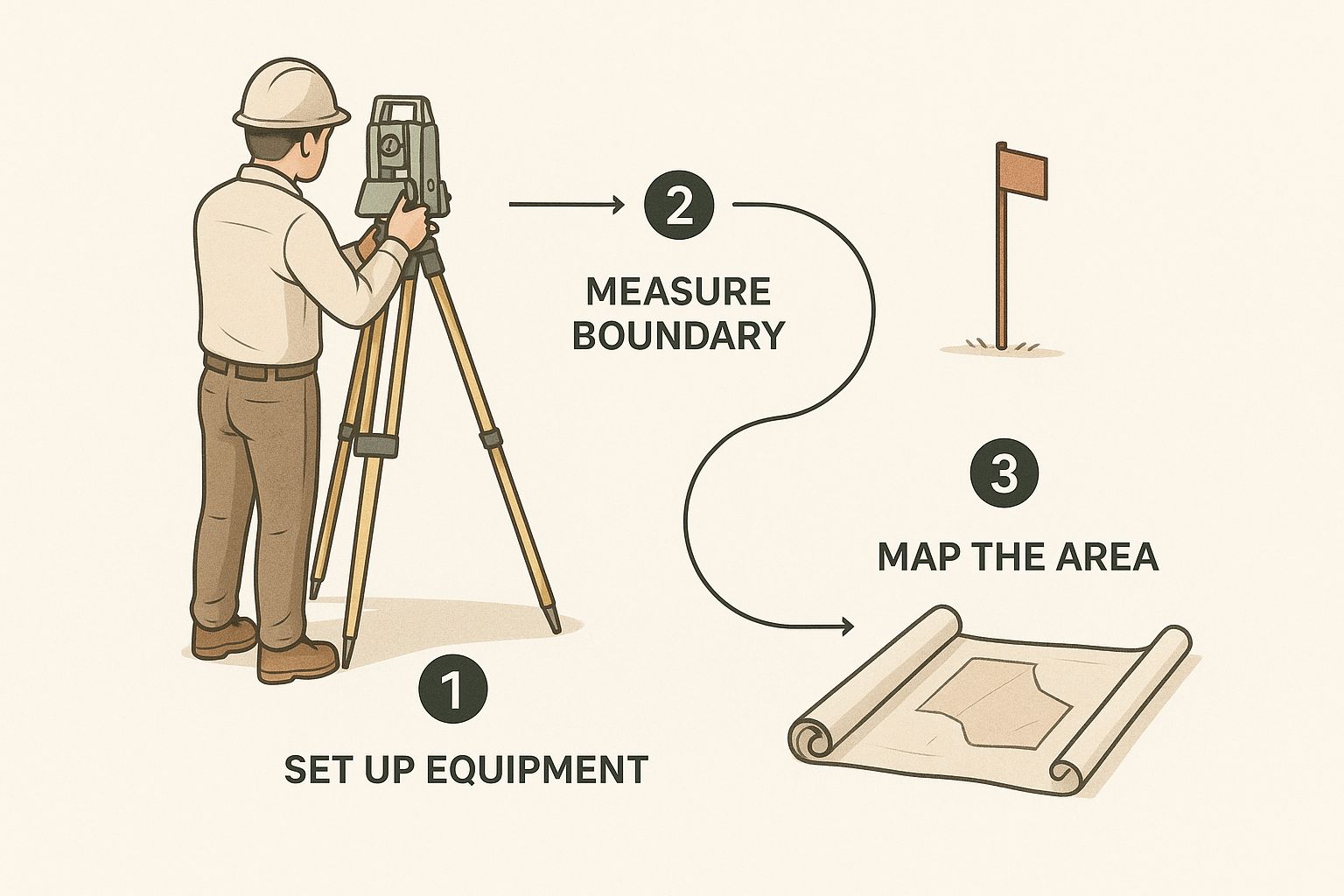
As you can see, it's a blend of historical detective work and modern, on-the-ground tech that produces the authoritative property plat.
Stage 1: The Registry Research
The journey doesn't start on your land—it begins in the archives. A licensed surveyor puts on their detective hat and dives deep into public records, tracing your property's paper trail back through time. This research phase is absolutely essential for establishing a clear chain of title and understanding the property's legal DNA.
The surveyor is on the hunt for a few key documents:
- Original Deeds: These are the foundational legal descriptions of the property from when it was first carved out.
- Previous Surveys: Any maps from the past offer crucial clues and show how the boundary lines have been interpreted over the years.
- Recorded Plats: These are the official maps of subdivisions or land parcels filed with the county, providing critical context for the neighborhood.
This initial digging pieces together the historical puzzle of your property. It creates the baseline for everything that happens next and ensures the final survey is built on a rock-solid legal foundation.
Stage 2: The On-Site Fieldwork
With the historical records in hand, the surveyor moves from the archives to your actual property. This is where tradition meets technology. The first order of business is to physically locate any existing boundary markers. These aren't always obvious—they could be anything from iron pins and concrete monuments to old stone walls or even specific trees mentioned in a centuries-old deed.
They use a mix of old-school monument hunting and seriously advanced gear. Modern tools like GPS and robotic total stations capture incredibly precise measurements, often accurate down to a fraction of an inch. This whole process is about methodically connecting the dots from the paper records to physical points on the earth.
A boundary survey is a multi-step process that combines deep research, precise fieldwork, and expert mapping to establish property limits. The surveyor’s job is to reconcile the historical paper trail with the physical evidence on the ground.
Stage 3: The Mapping and Plat Preparation
The final stage is where it all comes together. The surveyor takes all the field measurements and historical data back to the office to create the official survey map, known as a plat. This is far more than just a drawing; it’s a detailed, legally recognized document that tells the complete story of your property lines.
The finished plat will clearly show:
- The exact boundary lines with precise dimensions.
- The location of all property corners and any monuments that were found or set.
- Any encroachments, like a neighbor’s fence or shed that crosses over the line.
- Easements or rights-of-way that impact how your property can be used.
This journey from dusty archives to a final, easy-to-understand blueprint of your land is what makes a boundary survey so reliable. The final plat becomes the official record, a defensible document you can count on for everything from getting title insurance to planning a major development. To learn more about this process, you can explore additional insights on what is a boundary survey and the specific situations where you might need one.
Why a Survey Is Your Best Defense

It’s one thing to understand the process of a boundary survey, but it’s another thing entirely to appreciate its role as your ultimate risk management tool. Think of a survey less like an expense and more like a suit of armor for your property. It’s often the single document that stands between peaceful ownership and a costly, emotionally draining legal battle with a neighbor.
This certified map is your best defense against common—but serious—problems. Imagine your neighbor decides to build a new fence, but it creeps three feet onto your land. Without a survey, it's just your word against theirs. A boundary survey completely changes that dynamic by replacing opinion with fact, giving you the legal evidence needed to resolve the issue quickly and definitively.
Securing Your Financial and Legal Standing
Beyond settling neighborly disputes, a boundary survey is a non-negotiable requirement for several critical financial and legal steps. It's the key that unlocks the next stage of your property journey, making sure everyone involved is working from the same source of truth.
A survey is absolutely essential for:
- Securing Title Insurance: A title company simply won't insure against boundary-related issues without a current, accurate survey on file.
- Getting a Mortgage: Lenders demand a survey to verify the property's size and confirm there are no encroachments that could sink their collateral's value.
- Obtaining Building Permits: Before you can build an addition, a garage, or even a deck, most municipalities require a survey to prove you're building within your legal property lines.
The global impact of this simple document is immense. Land transactions are the foundation of about 70% of the world’s economy, and accurate surveys are the bedrock these deals are built on. As land values climb, so does the demand for precise boundary verification to prevent the kinds of disputes that can stall transactions and kill development projects. You can read more about the economic importance of boundary surveys and their role in market integrity.
A boundary survey isn't just about drawing lines on a map; it's about providing the certainty and legal standing you need for secure ownership, financing, and future development. It is the proactive step that provides true peace of mind.
From Defensive Document to Active Asset
The information a survey provides is invaluable, but its power is limited if it’s just collecting dust in a file cabinet. That's where the logical next step comes in—turning that static document into a dynamic, manageable asset. Managing this data is just as important as getting it in the first place.
Platforms like TitleTrackr act as a command center for all your critical property data. Instead of reacting when problems pop up, you can proactively manage your land records, survey details, and title information in one organized system. By making your survey data accessible and actionable, you transform it from a simple defense mechanism into a powerful tool for asset management.
Turning Your Survey Into Action
So, we've established that a boundary survey is far more than just a technical drawing with lines and numbers. It's the ultimate source of truth for your property, giving you the kind of legal clarity and financial security you can't get anywhere else. We've walked through what it is, how surveyors create one, and why it's such an indispensable tool for any landowner, developer, or energy professional.
Now that you understand its power, what’s next? You need to protect and use this critical information. A survey holds immense value on its own, but its true potential is only unlocked when you actively manage the data it contains. Otherwise, it just becomes another document filed away in a cabinet, its insights gathering dust until a crisis forces you to find it.
From Static Document to Dynamic Asset
Instead of letting that survey become a historical artifact, you can turn it into an active tool for managing your most valuable asset. The details on that plat—the exact property lines, the surprise encroachments, the critical easements—are all vital pieces of intelligence. When you have that information organized and at your fingertips, you can make smarter, faster decisions about your property.
This is where you shift from a defensive stance to an offensive one, using the survey data to build your strategy.
Think of it like this: A boundary survey is the blueprint of your asset. Managing it effectively is how you build, protect, and grow its value over time.
This proactive approach is an absolute game-changer for anyone managing multiple properties or complex land records. Take landmen, for example. They're often overseeing vast mineral rights or energy leases, and their entire operation depends on having precise and accessible survey data. You can learn more about the tools that empower land and energy professionals in our detailed guide. For them, making this data easy to find and use isn't just a convenience—it's the key to success.
Your Property Data Command Center
To truly activate your survey, you need a system that treats it like the critical asset it is. TitleTrackr was designed from the ground up to be that command center for all your property data. Our platform helps you secure and organize your property's vital records, turning static survey plats and dense title documents into a searchable, actionable database.
With TitleTrackr, you can:
- Centralize Your Documents: Keep all your surveys, deeds, and title reports in one secure spot that’s easy for your whole team to access.
- Extract Key Data: Instantly pull critical information from complex legal descriptions and survey notes without having to read every single word.
- Improve Workflow: Make your property information immediately available, slashing the time your team spends digging through old files.
Don't let the value of your boundary survey fade away in a forgotten folder. Take control of your property information and turn it into your greatest advantage.
Request a demo today to see how TitleTrackr can help you secure, organize, and act on your property's most vital records.
Still Have Questions? Let’s Clear Things Up.
Even after you get the hang of what a boundary survey is, a few practical questions almost always pop up. It's one thing to understand the concept, but another to navigate the real-world costs, timelines, and legal needs. This is where things can feel a bit overwhelming.
Let's cut through the confusion. Here are some clear, straightforward answers to the questions we hear most often, so you can move forward with confidence and protect your most valuable asset.
How Much Is This Going to Cost Me?
This is usually the first question on everyone's mind, and for good reason. But the answer isn’t a simple, flat fee. The cost of a boundary survey can swing pretty widely based on a few key factors. Think of it less like buying a product off the shelf and more like commissioning a custom piece of research that requires specialized fieldwork.
Several things directly influence the final price tag:
- Property Size and Shape: A sprawling, oddly-shaped rural parcel is a much bigger job than a neat little rectangular lot in a well-documented subdivision. More land and more corners mean more work.
- Terrain and Vegetation: A flat, open field is a surveyor’s dream. A steep, heavily wooded lot covered in thick underbrush? That’s a nightmare. Anything that obstructs sightlines adds time and complexity.
- The State of the Records: If the property’s historical records are clean, complete, and easy to find, the research phase goes smoothly. But if we’re dealing with conflicting deeds or missing documents, that adds a ton of time and detective work.
- Time Since the Last Survey: If a property hasn't been surveyed in a century, we're essentially starting from scratch, hunting for ancient markers. Compare that to a property surveyed just a decade ago, and you can see why the cost would differ.
On average, you can expect a residential boundary survey to run anywhere from $500 to over $2,000. For large commercial or rural tracts, the price can climb much higher. The only way to know for sure is to get a detailed quote from a licensed surveyor who can take a look at your specific piece of land.
How Long Does a Boundary Survey Take?
Just like cost, the timeline for a survey is all about complexity. The crew might only be on-site for a day, but that’s just one piece of the puzzle. The entire process, from start to finish, is much longer. A surveyor’s backlog, the rabbit hole of historical research, and even a week of bad weather can all stretch the timeline.
A boundary survey is a meticulous process, not a rush job. The time invested in research and fieldwork directly correlates to the accuracy and legal defensibility of the final plat.
For a typical residential lot, you can usually expect the whole process to take between two and four weeks. But for more complex properties with messy records or tough terrain, it could easily extend to several months. If you’re on a deadline for a real estate closing or a construction project, make sure you communicate that to your surveyor right from the start.
There’s an Old Survey on File. Do I Really Need a New One?
This question comes up all the time, and it’s a crucial one. Just because a survey exists doesn't mean it’s good enough for what you need today. Lenders and title companies almost always require a recent survey—usually one done in the last six months—to make sure nothing has changed. They need to know that a neighbor’s new fence isn’t creeping over the line or that a new shed hasn’t been built in an easement.
You absolutely need a new survey in these situations:
- Buying or Selling Property: A fresh survey protects everyone involved by showing the exact, current state of the property. No surprises.
- Building a Fence or Addition: Before you sink a single fence post or pour a foundation, a new survey is your insurance policy to make sure you’re building on your own land.
- Settling a Dispute: If you and a neighbor are at odds over the property line, an old survey might not carry much weight. A new one provides current, legally-binding evidence.
- Subdividing Land: If you're splitting a larger tract into smaller parcels, a new survey is legally required to create the new boundary lines for each lot.
Think of an old survey as a valuable historical document. It’s a great piece of the property's story, but it’s no substitute for a new one when you’re making major financial or legal decisions.
Managing the critical data from your boundary surveys, deeds, and title reports shouldn't be a headache. With TitleTrackr, you can turn static documents into actionable intelligence. Our AI-driven platform helps you organize, search, and analyze your property records with incredible speed and precision. Stop digging through files and start making data-driven decisions. Request a demo to see how you can transform your workflow at https://titletrackr.com.

Leave a comment