

Reading a plat map for the first time can feel like trying to solve a puzzle with no picture on the box. It’s a dense web of lines, strange symbols, and technical notes that seems completely overwhelming.
But for any real estate pro, this single document is one of the most powerful tools you have for truly understanding a piece of land. Mastering it isn't just a "nice-to-have" skill—it's absolutely essential for managing risk and advising clients with confidence. This guide will provide the insights you need to read plats like an expert and introduce a smarter way to handle the process.
Your First Look at a Plat Map

So, what exactly is it? Think of a plat map as the official blueprint for a neighborhood or a commercial development, drawn up by a surveyor long before the first shovel hits the dirt. It’s a detailed diagram illustrating how a large tract of land gets divided into smaller pieces.
The Foundation of Property Intelligence
At its heart, a plat map exists to create a clear, legally recognized record of a property's dimensions and layout. It’s what turns the dense, confusing legal description in a deed into something you can actually see and understand. This visual data is critical for heading off boundary disputes and making sure every transaction is built on solid facts, not just assumptions.
A good plat map will always show you a few key things:
- Property Lines: The exact, legally defined boundaries of a parcel.
- Lot and Block Numbers: How the bigger tract is broken down into smaller, sellable lots.
- Easements: Specific areas where others, like utility companies, have a legal right to access the land.
- Public Rights-of-Way: The designated locations for streets, alleys, and sidewalks.
A plat map translates the abstract language of a deed into a concrete, visual story. It gives you a clear picture of a property's potential and its built-in restrictions, providing the context you need to make smart, informed decisions.
This skill is a cornerstone of real estate, and its importance has only grown. As cities expand, the accuracy of these maps becomes even more critical. Thankfully, modern digital tools have made them far more accessible; by 2020, over 80% of U.S. local governments were already using GIS-based plat maps for greater precision.
Don't underestimate the stakes. An estimated 90% of property disputes worldwide involve a misinterpretation of plat details, which just goes to show how crucial it is to get this right. You can read more about the evolution of land data statistics and see their impact on global markets.
To get started, you need to know what to look for. While every plat map is a little different, they all share a few core components that tell the property's story.
Key Components on a Plat Map
Here’s a quick-glance table of the five most critical elements you'll find on any plat map and why they matter.
| Component | What It Shows | Why It Matters |
|---|---|---|
| Scale | The ratio of distance on the map to the actual distance on the ground (e.g., 1 inch = 100 feet). | Without it, you can't accurately measure lot sizes, setbacks, or distances. It's the key to understanding the true physical dimensions. |
| North Arrow | A symbol indicating the map's orientation, showing which direction is north. | This is your compass. It allows you to orient the map with the real world, which is crucial for understanding sun exposure and property placement. |
| Legend or Key | An explanation of the various symbols, lines, and abbreviations used on the map. | This is the map's dictionary. It translates technical symbols for things like easements, monuments, and utility lines into plain language. |
| Bearings & Distances | A series of measurements that describe the direction and length of each property line. | These are the precise, legally-binding instructions that define the exact shape and size of the property boundaries. |
| Monuments | Physical markers (like iron pins or concrete blocks) placed at property corners by surveyors. | These are the real-world anchors for the map's data. They confirm where the property lines begin and end on the actual ground. |
Getting comfortable with these five elements is the first and most important step. Once you can find and interpret them, the rest of the map will start to make perfect sense.
Breaking Down a Plat Map: The Key Elements
When you first look at a plat map, it can feel like you're trying to read a foreign language. But once you know where to look, you can move from a high-level view to a detailed inspection that tells the true story of a property. Every single symbol, note, and line is a piece of a much larger puzzle.
The most critical information is usually grouped together in a few key spots. Your first stop should always be the title block. This is where you'll find the essentials: the subdivision name, its location, and, crucially, the date the survey was prepared. An old revision date is an immediate red flag. It tells you the map might not reflect recent changes, which could be anything from a new easement to a re-drawn property line.
Just as important is the surveyor's certification and seal. This is the surveyor's professional stamp of approval, their guarantee that the map is accurate and meets industry standards. If you see a map without a seal, stop right there. That document isn't legally valid and shouldn't be trusted for any transaction.
Getting Your Bearings
Before you can dive into the nitty-gritty, you have to get oriented. The first thing to find is the north arrow. It’s a simple symbol, but it’s your compass for the entire document. It lets you align the drawing with its actual geographic position, which is critical for understanding everything from sun exposure to how the property sits in relation to its neighbors.
Next, find the scale. This is the Rosetta Stone for understanding the property's real-world size, usually written as something like "1 inch = 100 feet". Without the scale, the map is just a drawing without any context. For instance, if the scale is 1”=50’, a line on the map that you measure as four inches long represents an actual distance of 200 feet on the ground.
A plat map without a clear scale or north arrow is like a story without a setting. These two elements provide the fundamental context you need to interpret every other piece of information accurately and confidently.
Learning the Language of Lines and Symbols
With your bearings set, it's time to decode the map’s unique language. Head straight for the legend or key. Think of the legend as your personal dictionary, translating all those different symbols and line types into plain English. It's where you'll find out what that dotted line means versus a solid one, or how to spot a utility easement at a glance.
Some of the most common elements you’ll need to pick out are:
- Lot and Block Numbers: These are the primary IDs for individual parcels within the subdivision. They’re like a street address but for a specific piece of land.
- Road Dedications: These lines show which areas have been set aside for public use, like streets and alleys.
- Utility Easements: You'll often see these as dashed lines. They mark out where utility companies have the legal right to install and maintain their infrastructure, like power, water, or sewer lines.
Getting comfortable with these elements is a fundamental skill for any title professional. For those looking to really sharpen their expertise, understanding the advanced tools now available to modern title abstractors can give you a massive edge in spotting these crucial details quickly and accurately. Each component works together, turning a dense technical document into a clear source of actionable information.
Understanding Boundaries, Bearings, and Legal Descriptions
This is where a plat map gets serious. We’re moving beyond general layout and into the precise, legal language that defines a property's edge. Get this part wrong, and you could be walking your client straight into a costly legal mess down the line. It happens more often than you’d think.
At the heart of this precision is a system called metes and bounds. The easiest way to think of it is a highly specific set of directions for walking the perimeter of a property. It uses bearings (the direction of travel) and distances to trace the exact shape of the land, always starting from a fixed Point of Beginning (POB).
Following the Surveyor's Path
Every single boundary line on the map will have a "callout"—a piece of text like N 15° 30′ 45″ E, 166.25'. This isn't just jargon. It’s a direct instruction: the line runs northeast at a very specific 15-degree angle for exactly 166.25 feet. You follow these calls one by one, moving from corner to corner around the lot, until you've traced the entire boundary and landed right back where you started at the POB.
Of course, these descriptions need to be anchored to something in the real world. That’s where monuments come in. They are the physical markers that prove where these lines start and stop. Monuments can be:
- Natural Monuments: Things that were already there, like a specific old tree, the edge of a stream, or a large, identifiable rock.
- Artificial Monuments: Markers placed by a surveyor, which are most often iron pins or concrete posts set at the property corners.
These monuments are the physical evidence. They give tangible weight to the numbers and angles you see on the map.
Deciphering the Plat Legend
The infographic below is a great cheat sheet for decoding the common symbols and line types you'll find on any plat.
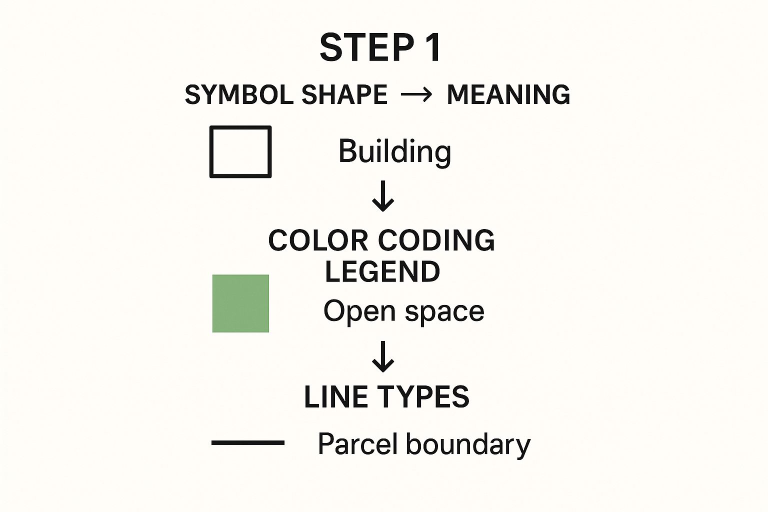
As you can see, the legend is your key. It’s what lets you quickly tell the difference between a property line, a building setback, and a designated open space.
While metes and bounds is a classic, it's not the only system. Many states, especially out West and in the Midwest, rely on the Public Land Survey System (PLSS). This is a massive grid that divides land into townships and sections, providing a more uniform way to describe where a property is. A plat map will almost always reference its location within this larger grid system.
The legal description is the DNA of a property boundary. It’s an unforgiving language where precision is everything. Translating it correctly is the only way to form a clear mental image of the property’s exact boundaries and protect a deal from costly errors.
The stakes here are huge. With around 6 million homes sold each year in the U.S., the vast majority of those deals rely on a plat map to confirm what’s actually being sold. In fact, over 75% of these sales require a close review of a recorded plat just to ensure legal compliance.
But mistakes happen. Boundary disputes now make up nearly 40% of all property law cases—a staggering statistic that shows just how financially risky a simple misinterpretation can be.
For any real estate professional, mastering these descriptions is non-negotiable. It’s how you protect your clients and your reputation. For landmen, who often deal with complex title chains and mineral rights, having the right tools to interpret this data is absolutely essential. You can see more of our insights for landmen working in the energy sector to understand how deep this can go. By speaking this language fluently, you can confidently steer your deals clear of preventable, and very expensive, mistakes.
Finding Easements, Setbacks, and Hidden Restrictions

Any seasoned pro knows the lines inside a property's boundary are often just as critical as the ones that define its edges. When you overlook these internal restrictions, you're setting your client up for a potential disaster. A dream project can quickly become a logistical and financial nightmare.
We're talking about the easements, setbacks, and other notes that dictate what a landowner can and cannot do. They’re the hidden rules of the game.
Easements are probably the most common—and most frequently misunderstood—of these restrictions. An easement doesn't grant ownership. Instead, it gives another party a specific right to use a portion of the property for a designated purpose, limiting the owner's absolute control.
Common Types of Easements to Watch For
On a plat map, you'll see easements marked in various ways, often with dashed lines and specific labels you can cross-reference in the legend. Knowing what you're looking for is a huge part of reading a plat correctly.
- Utility Easements: These are everywhere. They give utility companies the right to access the land to install, maintain, or repair things like power lines, water pipes, and sewer systems. A 10-foot utility easement along the back of a property means your client can't build a permanent structure, like a garage or a pool, in that zone.
- Access Easements: This is all about the right to travel across a property. The classic example is a shared driveway where one neighbor has to cross another's land to get to their own house.
- Drainage Easements: These are designed to manage water flow, ensuring stormwater runoff doesn't flood neighboring properties. Any construction or even significant landscaping is usually a no-go here.
The Impact of Setbacks and Building Lines
Beyond easements, you have to find the building setback lines. These are zoning requirements that dictate how far from the property lines any structures must be built. A plat map will show these as dotted or dashed lines set just inside the main boundary.
For example, a plat might specify a 25-foot front setback, a 10-foot side setback, and a 20-foot rear setback. If a client is dreaming of adding a huge deck to the back of their house, that 20-foot rear setback could be the detail that kills the plan before it even starts.
Overlooking a single restriction—like a drainage easement or a building line—can halt a project in its tracks. It's not just an inconvenience; it can lead to significant financial loss and even legal liability.
Imagine a developer who starts construction on a new commercial building, only to find out they poured the foundation five feet inside a recorded utility easement. The cost to redesign and rebuild could easily hit tens of thousands of dollars, all because one detail on the plat map was missed.
This is exactly why a meticulous, painstaking review process is non-negotiable. But manually scanning dense, complex plats is just asking for human error. One missed line can jeopardize an entire deal.
Modern tools are changing the game here. By automating the extraction of these critical details, platforms like TitleTrackr give professionals the confidence that no easement, setback, or hidden restriction goes unnoticed.
Protecting your clients from these costly surprises starts with a deep, accurate understanding of every line on the map. Ready to see how AI can ensure you never miss a critical detail again? Request a demo of TitleTrackr and discover a smarter, more accurate way to analyze property documents.
Common Plat Reading Mistakes You Can Avoid
Even the sharpest real estate pros can slip up when interpreting a plat map. A tiny oversight might seem minor, but it can quickly spiral into a deal-killing disaster with huge financial fallout. Knowing where others have stumbled is the best way to keep your own transactions safe.
One of the easiest traps to fall into is misjudging the map’s scale. It's tempting to just eyeball a boundary line, but guessing at distances without actually confirming the scale can lead to massive errors when calculating lot size or setback requirements. A simple gut check is never enough—always use a ruler and do the math.
Another critical mistake is failing to verify the recording date. Plats get updated all the time by developers and municipalities. If you’re working from an old map, you could be basing decisions on information that’s no longer legally valid. You might completely miss a new easement or a redrawn property line. Always, always check the county records for the most recently filed version.
Confusing Key Details
It’s also surprisingly easy to get tangled up in the details, especially on a dense or poorly scanned plat. Mistaking a setback line for a utility easement, for instance, could lead your client to believe they can build in an area that's actually off-limits. This is where relying solely on manual review starts to show its cracks.
Here’s why the human eye alone isn't enough:
- Human Fatigue: After hours of scanning complex documents, it’s only natural for focus to fade and for tiny details to get missed.
- Inconsistent Data: Different surveyors sometimes use slightly different symbols, which can create serious confusion.
- Time Pressure: When you're rushing to meet a tight deadline, the odds of an oversight skyrocket.
Relying on the human eye alone invites errors that can jeopardize a deal. A single missed detail—a forgotten easement, an incorrect scale measurement, an old recording date—can create costly delays and legal disputes that were entirely preventable.
This is precisely why top teams are moving away from purely manual processes. The risk is just too high when accuracy is everything. Before you can be confident in your interpretation, you need to be sure you haven't missed a critical detail hidden in plain sight.
Manual Review vs Automated Analysis with TitleTrackr
The limitations of manual plat review become even clearer when compared to an automated solution designed to catch what the human eye might miss. The right technology acts as a safety net, ensuring accuracy without sacrificing speed.
| Challenge | Manual Review Risk | TitleTrackr Solution |
|---|---|---|
| Complex Details | High potential for misinterpreting symbols, easements, and boundary markers due to fatigue or inexperience. | AI-powered analysis flags and identifies all key elements, reducing human error. |
| Outdated Information | Risk of using an older plat version, leading to decisions based on non-binding, invalid data. | Systematic data verification ensures you are always working with the most current recorded documents. |
| Scale Miscalculations | Eyeballing distances or simple math errors can lead to significant inaccuracies in lot dimensions. | Automated measurements calculate precise dimensions and setbacks based on the map's verified scale. |
| Time Constraints | Rushed reviews under pressure often result in missed details and costly oversights. | Rapid data extraction delivers a complete analysis in minutes, freeing up time for strategic review. |
Ultimately, a system built to systematically check every detail provides a layer of security that manual review simply can't match. Automated solutions like TitleTrackr are designed to catch these critical details systematically. By using AI to analyze and extract data, you reduce liability and create a more efficient, accurate review process.
Stop leaving your deals exposed to preventable risks. See how TitleTrackr can safeguard your work by requesting a demo and ensure nothing gets missed.
Got Questions About Plat Maps? We've Got Answers.
To wrap things up, let's tackle some of the most common questions that pop up when dealing with plats. Getting these distinctions right can save you a world of headaches during a transaction and will solidify everything we've covered.
What's the Real Difference Between a Plat and a Survey?
This is easily one of the most frequent points of confusion, but the distinction is pretty straightforward once you get it.
A plat map is the big-picture view. Think of it as the official blueprint for an entire subdivision, showing how a developer carved a large piece of land into individual lots, streets, and common areas. This is the document that gets recorded with the county and becomes the legal framework for the whole neighborhood.
A property survey, on the other hand, zooms way in on a single parcel of land. It’s a highly detailed diagram of that one lot, showing its exact boundaries, dimensions, and any improvements like a house or a fence. The surveyor also notes any easements or encroachments they find on the ground.
A plat map shows you how all the puzzle pieces of a subdivision fit together. A survey puts one of those individual pieces under a microscope. You absolutely need both, but they serve very different functions.
Where Can I Get My Hands on an Official Plat Map?
Since official plat maps are public records, you can usually find them where other land records are filed. Your best bet is always the county recorder's office, Register of Deeds, or whatever your local equivalent is called.
Good news is, many counties have digitized their records, so you can often search for and download plats right from their websites. If you're doing more complex title work, a title company or a specialized data service will pull these for you as part of their research package. For other general questions, you might find an answer in our comprehensive FAQ section.
How Has GIS Technology Changed the Game for Plat Maps?
Geographic Information System (GIS) technology has completely transformed how we work with plat data. It’s a massive leap forward.
Instead of looking at a static PDF, GIS creates dynamic, layered maps. It overlays the plat information with other critical datasets—things like zoning rules, floodplains, utility lines, and even recent aerial photos. This gives you a much richer, real-world context for the property you're analyzing.
With GIS, you can:
- See the whole picture: Instantly understand how a property fits into its surroundings.
- Spot-check for accuracy: Overlay plat boundaries on satellite images to catch potential discrepancies.
- Access everything in one place: Pull up tons of property data through a single digital interface.
This shift is part of a much bigger trend. Back in 1820, global literacy was only around 12%. Fast forward to 2022, and it's up to 87%, meaning far more people could interpret complex legal descriptions. Tools like GIS are the next step in that evolution, making dense plat information more accessible and understandable for everyone in the industry. You can discover more insights about how literacy has shaped access to information to see just how far we've come.
Knowing how to read a plat map is a skill that directly protects your clients and your professional reputation. But even the sharpest expert can make a mistake, and manual review is incredibly slow. TitleTrackr uses AI to automate this entire process, pulling every critical detail with speed and precision so you never miss a thing.
Stop leaving your deals exposed to preventable risks. Request a demo of TitleTrackr today.

Leave a comment