

Your First Look At A Plat Map
Opening a plat map feels like stepping into a new world. Lines crisscross. Parcel numbers stare back at you. Before diving into measurements or legal jargon, pause. Locate the map’s foundational info first.
Think of it the same way you’d find your bearings in a new city: check the title and decode the legend. This simple move sets the stage for everything that follows, preventing costly mix-ups down the road.
Find The Title Block And Legend
Your eye will naturally drift to the corners—that’s where the Title Block lives. This compact section packs the who, what, when, and where of the survey. Inside, keep an eye out for:
- Name of the Subdivision: Identifies the development or neighborhood.
- Legal Description: Details the land’s official outline by section, township, and range.
- Recording Information: Shows the exact date plus the book and page where the map is filed.
- Surveyor’s Information: Names the licensed surveyor or engineering firm behind the work.
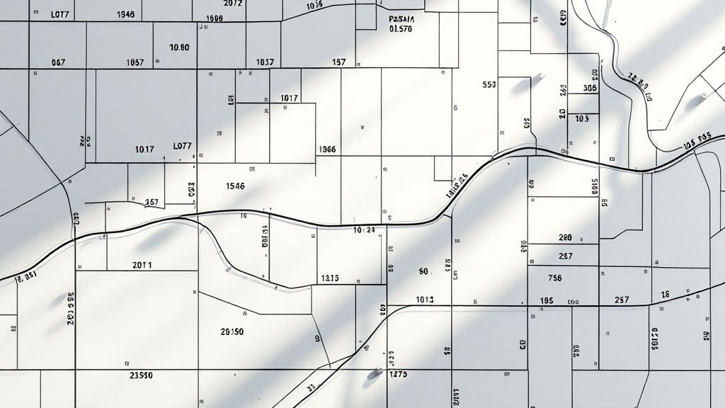
Right beside it, you’ll find the Legend. Treat it as your personal translator for every symbol, line style, and abbreviation on the page. A solid line usually marks a property boundary. A broken line? That might indicate a hidden utility easement.
Always check the legend before moving on. What represents an easement here could mean something entirely different on the next map.
Why This Foundation Matters
Plat maps have guided American land use since the Public Land Survey System began in the early 1800s. Today, a 2019 survey found that 57% of real estate professionals ended up in disputes over boundary lines or hidden easements. Outdated or misread maps are at fault in nearly 30% of development projects.
Grabbing the title block and absorbing the legend first is more than a habit—it’s your safeguard. With that context in place, every line, number, and note on the plat map becomes clear.
Quick Guide To Key Plat Map Elements
The table below summarizes the core sections you’ll encounter on any plat map—and why each one matters.
| Component | What It Tells You | Why It’s Important |
|---|---|---|
| Title Block | Survey dates, legal descriptions, recorder details | Sets the stage for accurate interpretation |
| Legend | Symbols, line types, abbreviations | Translates map shorthand into usable info |
| Scale Bar | Ground distance per map unit | Enables real-world measurements |
| Bearings & Distances | Directional headings and lengths | Pinpoints exact property lines |
| Lot Numbers | Parcel identifiers | Links each plot to official records |
Keep this guide close when you work through any plat map. Once those basics are in hand, you’ll tackle acreage, easements, and contours with confidence.
Now you’re poised to move deeper into the map. Next up, we’ll break down how to use scale and bearings to plot exact points on the ground.
Interpreting Lines, Symbols, and Easements
When you move past the title block and legend, the real work begins: translating lines and symbols into the story of the land. Every stroke—solid or dashed—and each shorthand note reveals where a property starts, where it ends, and what someone else might be allowed to do within those borders.
Solid lines mark the property boundaries, the legal perimeter you can build inside. Dashed or dotted lines, on the other hand, almost always point to an easement—a slice of land you own but someone else has the right to use.
Understanding Common Easements
Easements aren’t just lines on paper; they dictate how you can develop, landscape, or even fence your yard. Overlooking one could mean halted construction or an unexpected legal battle.
-
Utility Easements (U.E.)
Grant access for water, sewer, power, or communications lines. Never build a permanent structure over these. -
Access Easements
Provide a path from a landlocked parcel to a public road—or let neighbors share a driveway. -
Conservation Easements
Preserve sensitive areas like wetlands or wildlife habitats by restricting development.
“Even a narrow utility easement can gobble up 5% to 15% of a subdivision’s land. A 2020 study showed over 40% of plat maps in major U.S. metros include at least one utility easement to respect. In fast-growing regions of India, map misreads spark up to 20% of boundary disputes.”
Decoding Key Abbreviations And Markers
Plat maps rely on shorthand to pack loads of detail into tight spaces. If you skip the legend or assume a letter combo means one thing when it actually means another, you risk missing a critical restriction.
Pro Tip: Treat every abbreviation as unique. Cross-check with the map’s legend or notes—you’ll thank yourself later.
| Abbreviation | Meaning | What It Signifies |
|---|---|---|
| R/W | Right-of-Way | Land set aside for public use—think streets and sidewalks. |
| P.O.B. | Point Of Beginning | Starting point for a “metes and bounds” legal description. |
| B.L. | Building Line | Shows how close you can place a structure to the lot line. |
These lines and symbols aren’t mere suggestions—they’re legally binding. Pulling every detail from plats, deeds, and survey notes takes patience and precision. That’s why title searchers and abstractors often lean on specialized platforms to automate extraction, cut down on errors, and spend more time interpreting what the map reveals rather than hunting for it.
Making Sense of Measurements and Scale
Now we get into the real meat of a plat map—the numbers. This is where the bearings, distances, and scale come together to define a piece of property with mathematical precision. It might look like a foreign language at first, but once you crack the code, you can translate that flat piece of paper into a real-world, three-dimensional space.
The system that makes this all possible is called metes and bounds. It's an old but incredibly effective survey method that essentially draws the property's perimeter using a series of lines, each with its own specific direction (bearing) and length (distance).
This image shows a close-up of a plat map's legend, which is your key to understanding all the symbols, lines, and scales used.
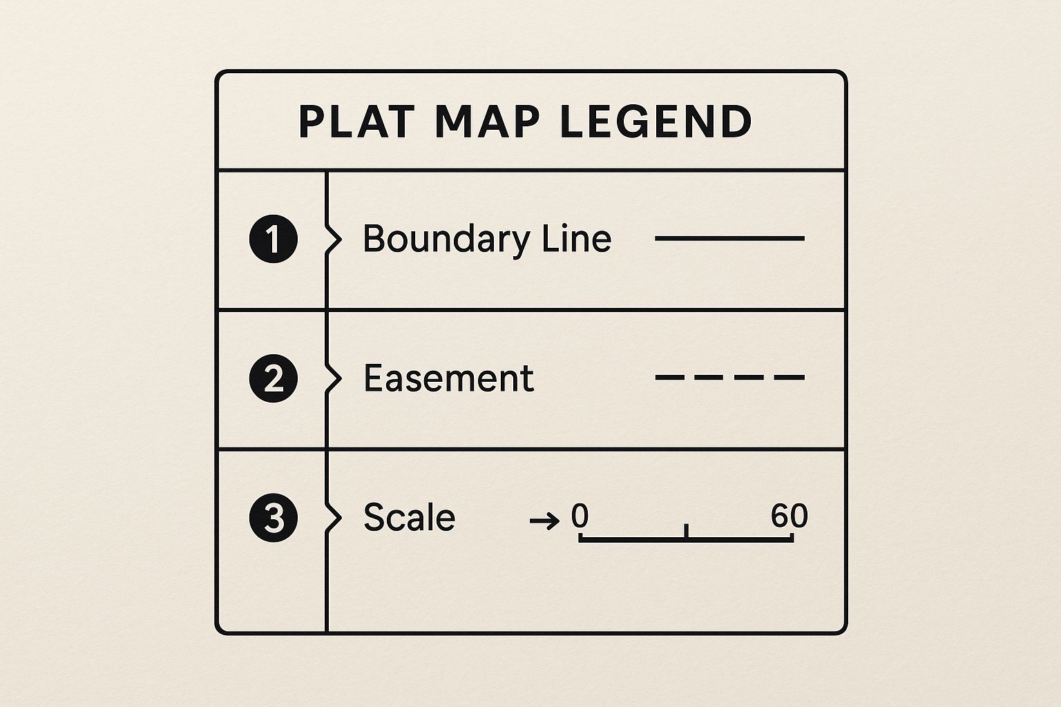
Think of the legend as your Rosetta Stone. It’s what turns abstract markings into clear, actionable information about the property’s layout and any associated rules or easements.
Decoding Bearings and Distances
Bearings are simply the direction of each property line, measured from either north or south. They can look intimidating, like N 89°15'30" E, but the breakdown is actually pretty straightforward:
- N: First, you face North.
- 89°15'30": Then, you turn 89 degrees, 15 minutes, and 30 seconds…
- E: …in the direction of East.
That incredibly specific angle, combined with a distance like 150.00', defines one single boundary line. It’s almost like a set of turn-by-turn directions for walking the property’s edge. You start at the "Point of Beginning" (or P.O.B.) and just follow each "call" (the bearing and distance pair) until you get right back to where you started.
A single misplaced degree or a misread foot can spiral into a massive boundary dispute down the line. When you're dealing with complex properties, manually checking hundreds of these calls is exactly where costly errors happen. It's this painstaking work that leads many firms to use AI-powered tools like TitleTrackr to automatically pull and verify legal descriptions, catching those tiny inconsistencies in seconds.
Putting Scale to Practical Use
The scale on the map is what lets you convert the measurements on the drawing into their actual size on the ground. A very common scale you’ll see is 1" = 100', which just means one inch on the paper equals 100 feet in the real world.
To use it, all you need is a ruler. If you measure a driveway on the plat and it's 0.75 inches long, you know its actual length is 75 feet (0.75" x 100'). It’s a simple calculation, but it’s incredibly valuable for quickly estimating setbacks, figuring out where a fence can go, or just double-checking that a planned building actually fits within the property lines.
Getting comfortable with these measurements isn't optional; it's essential for any accurate property analysis. It gives you the power to verify boundaries for yourself, plan projects with real confidence, and spot potential problems before they ever become expensive, real-world headaches.
Gaining an Edge with Historical Plat Maps
A current plat map gives you a snapshot of a property as it stands today. But to really understand a parcel's full story—and uncover potential headaches down the road—you have to look back in time. Historical plat maps provide an invaluable layer of context, revealing details that modern surveys might not show but can still carry serious legal weight.
This deeper dive into the past is a powerful strategy. You can identify forgotten easements, track how property lines have changed, or understand how a stream has meandered over decades. This historical knowledge is often your best tool for getting to the root of a long-standing neighborhood dispute or flagging a potential title issue before it blows up.
Where to Uncover Historical Land Records
Finding these older maps is easier than you might think. Both digital archives and old-school physical records offices hold the keys to a property's history.
Your best bets include:
- County Recorder's Office: This should be your first stop for official, recorded plats, some of which go back decades.
- Local Historical Societies: They often have treasure troves of old subdivision maps, aerial photos, and land-use documents you won't find anywhere else.
- Online Digital Archives: Websites dedicated to historical cartography can offer some surprising insights.
The real magic happens when you compare these historical documents against a modern survey. You might discover an old access road that’s no longer visible but still legally exists as an easement. For land professionals, this level of diligence is non-negotiable, and a deep understanding of historical land use can provide a massive advantage for any landmen working on complex projects.
Using Historical Context to Inform Current Decisions
Historical map collections have become essential for understanding how land evolves. The U.S. Geological Survey (USGS), for example, began digitizing its Historical Topographic Map Collection back in 2011. This project made nearly 190,000 maps produced between 1884 and 2006 available to the public. These maps show how infrastructure, geographical features, and property lines have changed, serving as a vital cross-reference to modern plats. You can learn more about these historical map collections at the Library of Congress.
This advanced tactic provides a complete picture that a single, current plat map simply can't offer. It transforms your ability to read plat maps from a simple exercise in interpretation to a strategic investigation of the property's entire lifecycle.
Think about it: a historical map might show a previous natural boundary, like a riverbank that has since been altered, which could impact current property lines. This context helps land professionals confirm boundaries, evaluate the true impact of old easements, and get ahead of potential zoning challenges. Mastering how to read plat maps now means incorporating this historical data as part of a complete land study.
Streamline Your Plat Map Analysis With AI

Manual plat map review is a skill we all pick up, but let’s be honest—it can swallow hours. One tiny slip in a boundary call or an overlooked easement notation can trigger costly delays or legal headaches.
When your desk is piled high with overlapping metes and bounds, cross-referencing each line feels like a mental marathon. That tedious grind leaves little room for the high-level insights your clients value most.
Amplify Your Expertise With Automation
Imagine uploading a plat map and, in minutes, getting back verified legal bearings, flagged easement areas, and a clear comparison to the official deed. That’s the power of TitleTrackr—it doesn’t replace your expertise, it turbocharges it.
Here’s what the AI handles for you:
- Legal Descriptions: Every bearing and distance auto-extracted and checked.
- Easement Identification: Utility, access, and conservation rights surfaced without manual digging.
- Document Comparison: Instant highlights of any discrepancies between plat and deed or survey.
With those routine tasks off your plate, you can zero in on what really matters—interpreting how the map impacts land use and strategy.
“Once I let AI tackle the grunt work, I finally had space to advise clients instead of wrestling with PDF scans.”
Solving Real-World Problems Faster
Think about a deed that just doesn’t line up with the recorded plat. Manually tracing every call can eat up an afternoon. An AI-driven check slashes that to seconds, pinpointing conflicts at a glance.
That kind of speed upends your workflow. You take on more complex jobs, deliver answers faster, and free yourself for the critical thinking that adds real value.
Reading plat maps is essential. But adding the right tools to make the process quicker and more accurate? That’s smart. If you’re ready to see how AI can refine your title searches and land analysis, request a personalized demo of TitleTrackr to watch it in action.
Common Questions About Reading Plat Maps
Whenever I’m knee-deep in these detailed grids, even well-known basics can spark new questions. Having straightforward, reliable answers is the only way to keep projects moving and avoid surprises later on. In my years reviewing hundreds of plat maps, I’ve noticed a handful of recurring hurdles that trip up both newcomers and seasoned pros. Below, I walk through those sticking points and share real-world tips to help you interpret maps with confidence.
Plat Map Versus Property Survey
It’s easy to mix these up, but they’re not interchangeable.
A plat map lays out an entire subdivision. You’ll see lots, blocks, streets, and shared spaces—essentially the big picture.
In contrast, a property survey zooms in on a single parcel. It records:
- Boundary lines and exact dimensions
- Locations of buildings and improvements
- Any encroachments or physical markers
Think of the plat map as the neighborhood’s blueprint and the survey as your lot’s precision draft.
Finding Official Plat Maps
Plat maps live in the public record. Your first stop is the county recorder’s or clerk’s office in the jurisdiction where the land sits.
Most counties provide:
- Property address searches
- Assessor’s Parcel Number (APN)
- Legal descriptions (tract, block, and lot)
When those county sites feel like a maze, I lean on resources like our detailed FAQ section for title professionals. It’s packed with tricks to speed up your search.
Using Plat Maps In Boundary Disputes
A plat map shows intended boundaries at the time the subdivision was filed, but it doesn’t carry legal weight in today’s disputes.
To settle a boundary issue, you’ll need:
- A fresh survey by a licensed professional
- On-the-ground measurements and visible markers
- Reference back to the original plat and any historical amendments
The plat map reveals where the line “should” have been. A current survey confirms where it “is” now.
Nailing down that distinction can make or break your case in court.
Why The Date Is So Important
Land doesn’t stand still. Roads expand, easements change, and lines can shift through legal actions. An outdated plat map might send you off on the wrong path.
Before you lean on any map:
- Check the recording date
- Compare it against the county’s most recent filings
- Confirm if any sections have been vacated or amended
Relying on stale data can turn a routine transaction into a costly mistake.
When poring over plat maps starts feeling like a time sink, it’s time to innovate. TitleTrackr automates the grunt work—verifying legal descriptions, flagging inconsistencies, and extracting key details in seconds.
That frees you to focus on strategy and keep projects moving. Stop spending hours on manual checks. Request a demo of TitleTrackr and see how you can bring speed, accuracy, and confidence to your next project.

Leave a comment