

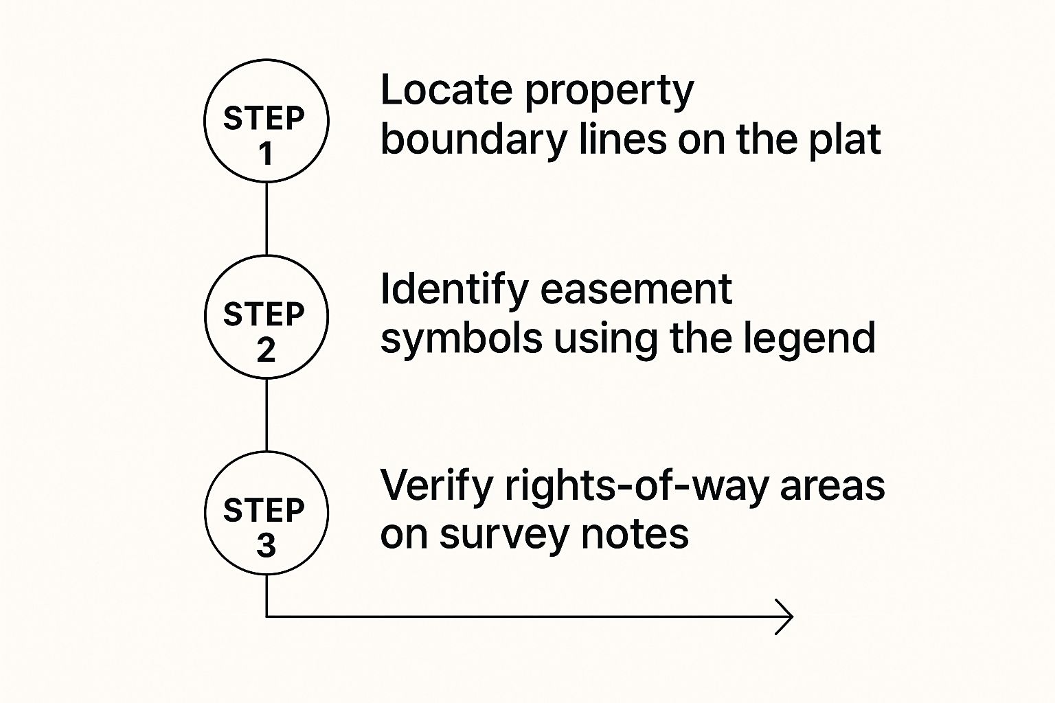
Learning how to read a plat map isn't as intimidating as it looks. It really comes down to systematically analyzing its five core components: the title block, the legend, the map itself, the surveyor's notes, and all the legal descriptions packed in. For any professional in real estate, development, or land management, it’s a non-negotiable skill. This single page tells the complete legal and physical story of a property, and misinterpreting it can lead to costly delays and disputes.
Your First Look at a Plat Map
Before you even try to trace a single line, it’s critical to get one thing straight: a plat map isn’t just a drawing. Think of it as a legally binding agreement that’s officially recorded with the county. It's the blueprint for a piece of land, defining everything from property divisions and public access rights to crucial building restrictions.
This one document is the foundation that prevents incredibly expensive property disputes down the road. It offers a standardized view of a subdivision, making sure everyone involved—from the developer to the homeowner—is working from the same set of facts.
To give you a quick reference, here are the essential parts you'll find on nearly every plat map.
Core Components of a Plat Map
| Component | Primary Function | What to Look For |
|---|---|---|
| Title Block | Provides basic identification | Subdivision name, recording date, location (county, state), surveyor's info. |
| Legend/Key | Explains the symbols used | Definitions for boundary lines, easements, utilities, monuments, and other map icons. |
| Graphical Map | Visual representation of the land | Lot numbers, dimensions, street layouts, bearings, and distances of property lines. |
| Surveyor's Notes | Adds context and clarification | Details on basis of bearings, specific restrictions, or unique property features. |
| Legal Description | Defines the property in words | The official text-based description used in deeds and other legal documents. |
Getting familiar with these components is the first step. Each one tells a piece of the property's story.
Why This Document Is So Vital
A plat map is much more than a simple survey. It's a detailed legal document that shows how a larger tract of land has been divided into lots, streets, and easements. These maps have been a cornerstone of clear land ownership in the U.S. since the 19th century.
It’s not uncommon for a single plat to represent hundreds of individual parcels. That’s why you have to get comfortable with details like the scale (often something like 1 inch = 100 feet), boundary symbols, and notes about easements. You can dig deeper into modern digital mapping trends on grandviewresearch.com.
For anyone touching a property transaction, its importance is huge. It directly impacts:
- Legal Ownership: The plat legally defines the precise boundaries of what you own.
- Development Potential: It outlines setbacks, easements, and other restrictions that dictate what can be built.
- Property Value: Clear boundaries and land use rights have a direct effect on a parcel’s market worth.
- Dispute Resolution: When a neighborly disagreement over a fence line pops up, this is the document everyone turns to.
Streamlining a Complex Process
Reading a plat correctly takes a sharp eye. Every symbol, number, and note carries real legal weight. Trying to review these documents manually is not only time-consuming but also wide open to human error. A missed easement or a misread boundary can have massive financial and legal blowback.
A plat is the story of the land, written in a language of lines, angles, and legal notes. Learning to read it is the first step toward making informed decisions about any property.
This is where modern tools can be a game-changer. For professionals who look at these documents day in and day out, accuracy and speed are everything. Platforms like TitleTrackr are built to help with this exact kind of complex interpretation, flagging details the human eye might miss and saving hours of painstaking review.
The work done by title searchers and abstractors becomes faster and far more reliable when technology can parse and highlight key information automatically. It turns a manual chore into a more manageable workflow, letting you focus on analysis instead of just deciphering symbols.
Translating Lines and Symbols
Every plat map is a visual language, telling a property's story through lines and symbols. Think of the legend as your dictionary—it's the first place you should look to understand what each specific marking actually means. Becoming fluent in how to read a plat starts here.
You’ll immediately notice the different line weights and styles. A solid, bold line is almost always the primary property boundary. This is the big one, the legally recognized perimeter of the parcel that defines the absolute extent of ownership.
Then you have the dashed or dotted lines that often cut across the property. In our experience, these nearly always represent easements. They carve out areas where another party—like a utility company or even a neighbor—has a legal right to access or use that slice of land.
Distinguishing Key Markers
It’s about more than just boundaries. Plats are filled with other crucial markers, and getting one wrong can have serious consequences. For instance, that thin line running parallel to the property edge might be a building setback line, which is a legally binding rule about how close you can build to the boundary.
Keep a sharp eye out for these common visual cues:
- Property Lines: Look for the heaviest, solid lines. These define the lot's perimeter.
- Easement Lines: Typically dashed (—) or a mix of dots and dashes (·-·-). These signal rights for utilities, access, or drainage.
- Setback Lines: Often shown as dotted lines (….) or faint solid lines, they create a no-build zone along the property's edges.
- Monuments: Small circles (o), triangles (△), or squares (□) pinpoint the physical corners of the property. The legend will tell you if it's an iron pin, a concrete marker, or something else.
Here’s a real-world scenario we’ve seen play out: a developer plans a new building right up to what they thought was a suggestion line on the map. They later find out it’s a 20-foot utility easement. Suddenly, their foundation plans are in direct violation. That one mistake can halt an entire project, forcing expensive redesigns and months of delays. It’s a perfect example of how one misunderstood line has a very real financial impact.
From Paper to Physical Ground
The symbols for monuments are especially critical because they bridge the gap between the drawing and the actual, physical land. A surveyor doesn’t just draw a line; they place physical markers like iron pins at the property corners. The plat map tells you what to look for and where to find it.
The goal isn't just to see the lines, but to understand the physical and legal reality they represent. This gives you the confidence to assess a property’s layout and limitations at a glance.
When you see "I.P. Fnd" in the legend next to a small circle symbol, you know an "Iron Pin Found" marks that corner out in the field. This empowers you to walk the property and visually confirm the boundaries you saw on paper.
Mastering this visual vocabulary is fundamental. Each symbol and line style adds another layer of information about the property’s use, its restrictions, and its physical layout. While it definitely requires a keen eye, the confidence you gain is invaluable. Of course, automating this tedious cross-referencing with a tool like TitleTrackr can prevent these costly errors, ensuring every symbol is correctly identified without spending hours on manual review.
Making Sense of Bearings and Dimensions

While the lines on a plat map give you the basic shape of a property, the real story is in the numbers. This is where precision lives. Getting these details right is non-negotiable, as even a small mistake can lead to big legal and financial headaches. To truly understand how to read a plat, you have to get comfortable with the figures.
Your first stop should be the map's scale, typically tucked away in the title block or legend. This is your decoder ring for converting what you see on paper into real-world distances. A common scale is 1” = 100’, which simply means one inch on the map equals one hundred feet on the ground.
Decoding Bearings and Directions
With the scale sorted, it's time to tackle the bearings. These are the specific angles that define the direction of each property line. At first glance, something like N 45° 30' 15" E can look pretty intimidating.
Let's break it down. It’s actually a set of simple instructions:
- N: This is your starting point—always North or South. In this case, you face North.
- 45° 30' 15": This is the angle you need to turn, measured in degrees (°), minutes ('), and seconds (").
- E: This is the direction of your turn—either East or West.
So, for N 45° 30' 15" E, you’d start by facing North, then turn exactly 45 degrees, 30 minutes, and 15 seconds toward the East. The number you see next to this bearing, like 150.00’, is the length of that boundary line.
Understanding Lot Dimensions and Curves
Property lines aren't always straight. For roads, cul-de-sacs, and other curved features, you'll find specific geometric data that allows a surveyor to recreate the curve perfectly.
Look for abbreviations like these:
- R is for Radius (the distance from the circle's center to the curve)
- L or A is for Arc Length (the actual distance you'd walk along the curve)
- C or CH is for Chord (the straight-line distance from one end of the curve to the other)
For surveyors and developers, this level of detail is everything. Even in real estate markets with literacy rates over 95%, professionals need specialized training because reading technical documents like plats is a completely different skill set. You can see how these skills vary on a global map of literacy rates from Visual Capitalist.
Every number on a plat—from a single degree in a bearing to a foot in a dimension—is a legally binding instruction. Miscalculating one can shift a boundary line, create an encroachment, or invalidate a building plan.
Trying to verify all of these measurements by hand is not only tedious but also risky. A misplaced decimal or a misread angle can quickly snowball into expensive problems. This is where modern tools give you a serious edge. Platforms like TitleTrackr can automate these calculations, cross-referencing bearings and dimensions to flag any inconsistencies. It takes the guesswork and human error out of the equation, giving you complete confidence in your analysis.
Finding Restrictions in Notes and Easements
The lines and angles on a plat map give a property its shape, but it's the text—the surveyor's notes and easements—that truly defines what you can and can't do with it. This is where the deal-killing details are often buried.
Ignoring this fine print is one of the most common and costly mistakes we see professionals make. A lot can look perfect on paper, but a single note can reveal a major utility easement that completely kills your plan to build a pool or an addition. These notes aren't just friendly suggestions; they are legally binding restrictions that can dramatically impact a property's value and use.
Decoding Different Types of Easements
Easements are essentially rights granted to other parties to use a specific portion of your property. They show up in several forms, and learning how to read a plat properly means knowing what each one implies for your land.
Here are the usual suspects:
- Utility Easements: By far the most common. These allow companies for electric, water, gas, and communications to run lines and access them for maintenance. A key rule of thumb: you almost never can build any permanent structures over these areas.
- Access Easements: These grant a neighbor or another party the right to travel across your land to get to theirs. You see this a lot with landlocked parcels where there's no other way to reach a public road.
- Drainage Easements: These are set aside to manage water flow, usually along a low point or a dedicated channel. You’re strictly prohibited from doing any building or landscaping that would block or alter this flow.
Let’s run through a quick scenario. Imagine you find a great commercial lot, perfect for the warehouse you want to build. The plat shows a wide, 30-foot dashed line cutting across the back third of the property. You dig into the notes and see it labeled a "Public Drainage Easement." Just like that, your building plans are in trouble because nothing can be constructed in that critical path.
The real constraints on a property are often found in the text, not the drawing. An easement can turn a seemingly perfect parcel into a development puzzle.
Don't Overlook Surveyor's Notes and Covenants
Beyond easements, the surveyor's notes and references to covenants, conditions, and restrictions (CC&Rs) hold a ton of vital information. The notes might tell you the basis of bearings, point out unique physical features on the land, or reference other legal documents tied to the property.
CC&Rs, which are often just referenced by a recording number on the plat, can dictate everything from the architectural style of your building to what kind of business you can operate. It's on you to look up those referenced documents to get the complete picture. If you're wondering how plats fit into the larger puzzle of property records, check out the questions answered in our FAQ section.
Hunting for these notes and cross-referencing legal documents by hand is incredibly tedious and, frankly, prone to error. Overlooking just one restriction can derail an entire project. This is exactly the kind of challenge TitleTrackr’s AI-powered platform was built for. It automatically scans, flags, and summarizes these critical notes, easements, and covenants, ensuring a hidden restriction never catches you by surprise again. By automating the grunt work, you can focus on making smart decisions instead of getting lost in the fine print.
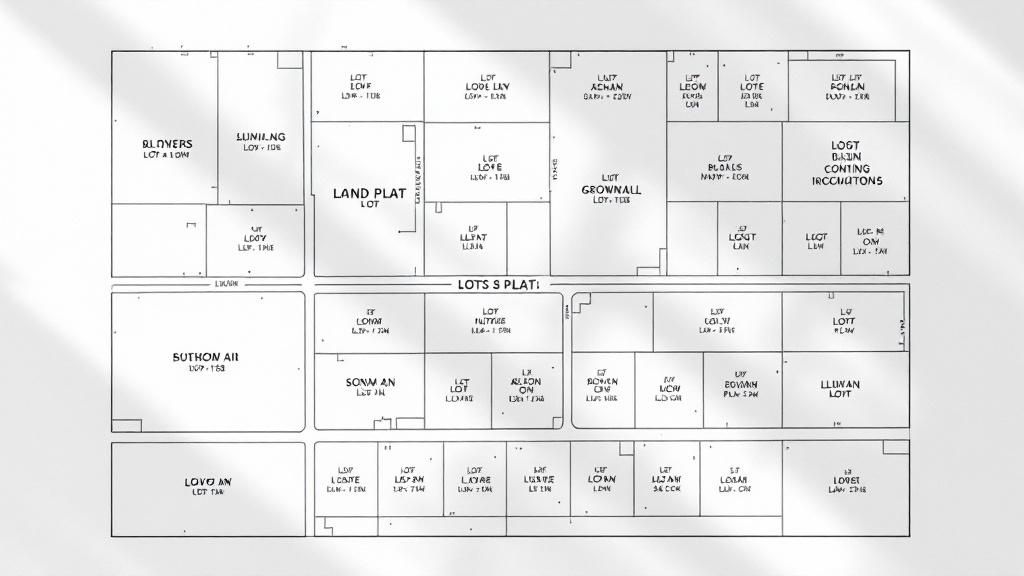
Putting It All Together: A Practical Plat Map Walkthrough
Theory is great, but getting your hands dirty is where the real learning happens. Let’s walk through a sample plat map from start to finish, just like a pro would, to make sure nothing gets missed. This is how all the concepts we've talked about connect in the real world.
First thing's first: find the title block. This is your anchor, confirming the subdivision's name, its location, and the date it was recorded. Just like that, you know you’re working with the right document. From there, your eyes should jump straight to the legend. This is the map's dictionary. In our example, we can see a solid line marks property boundaries, while a dashed line represents a "Utility Easement" (U.E.).
Tracing a Single Lot
Now, let's zoom in on one parcel—we'll use "Lot 10" for this exercise. The key is to find its starting corner, which is often a small circle that indicates a surveyor has placed an iron pin in the ground.
From that point, we just trace the boundaries by following the bearings and distances for each property line. The first callout reads N 89° 15' 30" E for a distance of 120.00 feet. You simply follow this process for every side until you've come full circle and enclosed the lot. It's a methodical process that confirms the lot's exact geometry.
This workflow—moving from the main boundaries to easements and then to the notes—is a repeatable system.
As you can see, the process is logical. You define the perimeter, identify any burdens on the property like easements, and then scan the text for specific rules or restrictions.
While tracing Lot 10, we spot that dashed U.E. line cutting across the back 10 feet of the property. This is a huge discovery. It immediately tells a potential owner that no permanent structures can be built in that specific zone.
Uncovering Hidden Restrictions in the Notes
Finally, we get to what we consider the most critical part: the surveyor's notes. This is where the easily missed—and often most important—details are hiding.
In our example, we find a note that says, "All lots are subject to the Covenants, Conditions, and Restrictions recorded in Book 123, Page 45." This is a massive find. It means there’s a whole other legal document out there that dictates how the land can be used, and it absolutely must be pulled and reviewed.
This exercise shows how reading a plat is really about layering information. The title block gives you identity, the legend gives you language, the map gives you geometry, and the notes give you the binding legal context.
This manual process works, but it’s slow and leaves way too much room for human error. One missed note or a single misread symbol can create major headaches down the road.
For professionals buried in land records, TitleTrackr's AI-driven platform automates this entire process. It can extract data, flag easements, and summarize surveyor notes in seconds, delivering insights that are both faster and more reliable. If you're looking to build similar efficiencies into your own systems, you can see how our technology works by checking out our documentation for developers and tech partners.
Plat Map FAQs
Even seasoned pros run into the same few head-scratchers when looking at plat maps. Let's clear up some of the most common questions we hear. Getting these straight will give you a ton of confidence next time you're looking at a plat.
Plat Map vs. Survey: What's the Difference?
This one trips people up all the time. Think of it like this: the plat map is the master blueprint for an entire subdivision. It's the official, recorded document showing how a developer carved a huge tract of land into individual lots, streets, and common areas.
A survey, on the other hand, is a close-up snapshot of a single piece of property. It’s created at a specific moment in time to show that one lot’s exact boundaries, dimensions, and any structures on it, like a house or a fence.
So, the plat is the neighborhood plan; the survey is the detailed look at your specific lot within that plan.
Where Can I Find the Plat Map for My Property?
Since they're official public records, plat maps are filed with the county, usually at the recorder's or clerk's office. The good news is that many counties have digitized their records, so you can often search for them online by address or parcel number.
If you work in the industry, you have a few other shortcuts:
- Title companies are your best bet. They have direct access to these records and pull them for nearly every transaction.
- Real estate agents can usually retrieve these documents for their clients pretty easily.
- Land surveyors obviously have copies of the plats they've created or used for their own work.
What Do All the Abbreviations on Curve Data Mean?
When you see a curved property line or a cul-de-sac, you'll spot a cluster of abbreviations defining its geometry. It's pretty straightforward once you know the code.
'R' stands for Radius, which is the distance from any point on the curve to the center of the circle it's part of. 'L' is the Arc Length—that’s the actual distance you’d walk if you followed the curve from one end to the other.
Finally, 'C' or 'CH' is the Chord, which is the straight-line "as the crow flies" distance between the two endpoints of the curve. With these three numbers, a surveyor can recreate that exact curve out in the field.
A Quick Word of Caution: A plat map, while an official document, isn't always the final word. Errors can happen, and things can change. Subsequent legal actions like lot line adjustments or new easements might have been recorded after the plat was filed. Always, always cross-reference the plat with the most recent title documents to get the full picture.
Manually digging through every line and symbol on a plat map is a recipe for missed details and wasted hours. With TitleTrackr, you can let AI handle the heavy lifting—extracting data, flagging restrictions, and building professional reports in a fraction of the time. See for yourself how much faster and more accurate your work can be.

Leave a comment