

Staring at a legal description can feel like trying to decipher a foreign language. But understanding it is crucial—it's the property's unique DNA. The first step is to identify which of the three main systems you're looking at: Metes and Bounds, the Public Land Survey System (PLSS), or Lot and Block. Each one defines a property's exact boundaries in a specific way, and it serves as the one and only official identifier for any real estate deal.
A Legal Description Is a Property's Unchanging Fingerprint
Think of a street address like a nickname. It’s great for getting mail or giving directions, but it can easily change over time. A legal description, on the other hand, is the property's true, unchangeable identity—its fingerprint. It’s the absolute bedrock of a real estate transaction, making sure everyone involved is talking about the exact same piece of land.
Getting one of these descriptions wrong isn’t a small slip-up. It can quickly snowball into expensive boundary disputes, nightmare zoning issues, or even a catastrophic financial loss if the wrong property gets bought or sold. This is precisely why a rock-solid understanding is non-negotiable for anyone working in real estate or energy. That's why top-tier professionals are turning to technology to automate verification and eliminate risk.
The Three Core Systems You'll Encounter
To really learn how to read legal descriptions, you have to know which type you're dealing with. Nearly every description you'll see falls into one of these three buckets:
- Metes and Bounds: This is the oldest system of them all. It literally tells a story, tracing the property's perimeter from a starting point using specific distances and directions.
- Public Land Survey System (PLSS): You’ll find this grid-based system across most of the United States. It carves up land into a predictable pattern of townships, ranges, and sections.
- Lot and Block: This is the go-to system for modern subdivisions. It’s the simplest of the three, referencing a specific lot and block number on a recorded map, or "plat."
Making sense of legal descriptions is fundamental to real estate transactions worldwide because it’s how we define precise property lines. Historically, these systems grew from simple land records into the complex, standardized formats we use today. In the U.S., the Public Land Survey System (PLSS), established by the Land Ordinance of 1785, was a game-changer. It divided vast territories into a grid of one-square-mile sections, each containing 640 acres. You can find some fascinating history about this system on worldatlas.com.
A flawed legal description can sink an entire deal. Accuracy isn't just a nice-to-have; it's an absolute must for a clean title transfer and a secure investment.
Each system comes with its own quirks, from the archaic language in old metes and bounds deeds to the confusing fractional calls in PLSS descriptions. For title searchers and land professionals, this isn't just a skill—it's the core of the job. The level of precision needed is immense, which is why many modern title abstractors now rely on advanced tools to double-check these descriptions and catch errors before they cause a major headache.
Later in this guide, we'll dive deep and break down each of these systems with real-world examples you can actually use.
Tracing Boundaries with Metes and Bounds
Think of a property description that reads less like a legal document and more like a story—a guided walk around the perimeter of a piece of land. That’s the core idea behind the Metes and Bounds system. It’s the oldest method we have for defining property boundaries, and it’s still incredibly common today.
The name itself tells you everything you need to know. 'Metes' refers to the distances, while 'Bounds' are the landmarks—natural or man-made—that stake out the corners.
Every metes and bounds description has to start somewhere, and that's the Point of Beginning (POB). From this exact spot, the description lays out a series of directional calls, each one defining a leg of the boundary journey. The whole thing is a narrative that absolutely must end right back where it started, creating a perfectly closed shape.
Decoding the Language of Directional Calls
To really understand how to read legal descriptions using this system, you have to get comfortable with its unique vocabulary. Each instruction, known as a "call," gives you a direction and a distance. It's like a set of turn-by-turn directions for a surveyor.
A typical call might look something like this: "thence North 85 degrees 15 minutes East for 210.50 feet to an iron pin."
Let's break that down. That one sentence gives you three critical pieces of information:
- Bearing: The direction of travel (North 85 degrees 15 minutes East). This is simply the angle measured from north or south.
- Distance: How far to go along that bearing (210.50 feet).
- Monument: The landmark that marks the end of that specific line (in this case, an iron pin).
The word "thence" just means "from there." It's the signal that you're moving from one call to the next. You just follow these calls one by one, tracing the entire property outline until the very last one brings you home to the POB.
The single most important rule of a Metes and Bounds description is that it must form a closed loop. If that final call doesn’t return exactly to the Point of Beginning, the description is broken. It's a fatal flaw that can create major title issues down the road.
Common Challenges with Metes and Bounds
For all its logic, the metes and bounds system isn't without its headaches, especially when you're dealing with older documents. The reliability of the "bounds" or monuments is often the biggest problem. An old description from the 1800s might reference "an old oak tree" or "the large rock by the creek." Good luck finding those today.
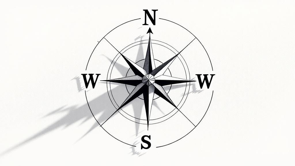
Another classic complication is magnetic declination. Early surveyors used magnetic compasses, but the Earth’s magnetic north isn't stationary—it drifts over time. A bearing recorded in 1850 won't point in the exact same direction today. To plot it accurately, you have to make adjustments.
These kinds of ambiguities are why trying to manually plot these descriptions is so risky. A single misplaced decimal or one wrong bearing can throw off the entire property's shape and size. Imagine checking hundreds of these calls by hand against historical records—it's incredibly tedious and a recipe for error.
This is where meticulous, automated verification becomes a lifesaver. Tools like TitleTrackr can automate this complex verification process, instantly flagging discrepancies that the human eye would almost certainly miss. It ensures every boundary closes perfectly before you move forward on a deal, giving you complete confidence in your title work.
Mastering the Grid-Based PLSS System
Across huge swaths of the United States, property isn't defined by landmarks or old fences. Instead, it’s mapped out on a massive grid called the Public Land Survey System (PLSS). A PLSS description can look like a cryptic string of letters and numbers at first, but it's actually one of the most logical systems for defining land ever created.
It all starts with a foundation of principal meridians (lines running north-south) and baselines (lines running east-west). These are the main arteries of the grid, serving as the reference point for millions of acres. From there, the land gets carved up into a giant checkerboard.
From Townships to Specific Parcels
The first big division creates townships, which are typically six-by-six-mile squares. Each one gets a unique identifier based on its position relative to that main meridian and baseline.
- Township lines are horizontal lines running parallel to the baseline.
- Range lines are vertical lines running parallel to the principal meridian.
So, a description like "T2N, R3W" simply means Township 2 North, Range 3 West. You're in the second row of townships north of the baseline and the third column of ranges west of the meridian. Simple enough. Each of these townships is then sliced into 36 one-square-mile sections.
The real trick to decoding a PLSS description is to read it backward. You start with the largest piece—the township and range—and work your way from right to left, zeroing in on the specific parcel. This simple shift in perspective turns a jumbled code into a clear address.
A Practical Example of a PLSS Description
Let's pull apart a real-world PLSS legal description: NE 1/4 of the SW 1/4 of Section 14, T2N, R3W.
If we read it from right to left, it becomes a set of simple directions:
- First, find Township 2 North, Range 3 West on the map.
- Inside that 36-square-mile township, locate Section 14.
- Next, look for the southwest quarter (SW 1/4) of that section. That's a 160-acre piece.
- Finally, pinpoint the northeast quarter (NE 1/4) of that southwest quarter.
And there you have it. That final step has led you to a specific 40-acre parcel of land. Once you get the hang of reading them in reverse, these descriptions start to make perfect sense. It gets a bit more complicated with irregular sections or multiple fractional calls, but the core logic stays the same.
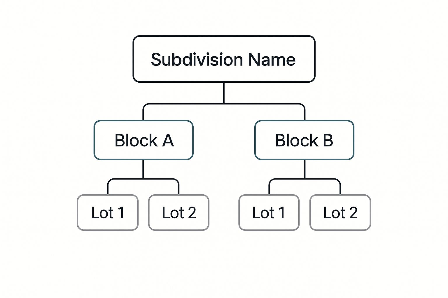
The image above visualizes a similar kind of hierarchical breakdown. Just like the PLSS, it shows how a larger area is systematically divided so every single piece has a unique, traceable identifier.
To help you get a feel for the scale, here's a quick reference for how the PLSS breaks down land measurements.
PLSS Hierarchy and Land Measurements
| Unit | Size | Equivalent Acreage |
|---|---|---|
| Township | 36 square miles | 23,040 acres |
| Section | 1 square mile | 640 acres |
| Half-Section | 1/2 square mile | 320 acres |
| Quarter-Section | 1/4 square mile | 160 acres |
| Quarter-Quarter Section | 1/16 square mile | 40 acres |
This table shows just how structured and predictable the system is, from massive townships down to small, 40-acre parcels.
It’s no surprise that mastering this system takes practice. In fact, over 90% of licensed surveyors and real estate attorneys get formal training on interpreting legal descriptions as part of their certification. It's a specialized skill, and you can discover more insights about specialized literacy requirements from the OECD.
Now, imagine trying to verify hundreds of these descriptions by hand. A single typo could shift a property miles away from its actual location. That’s why modern title professionals use automated tools. With a solution like TitleTrackr, you can validate PLSS descriptions in an instant, catch errors, and move on, turning a tedious manual task into a quick, reliable part of your workflow.
Navigating Subdivisions with Lot and Block
If you’re dealing with property in a planned community, suburb, or dense urban area, you'll run into the Lot and Block system constantly. It’s often a welcome sight. Compared to the storytelling of Metes and Bounds or the massive grid of the PLSS, this method is usually the most direct and easiest to decipher.
Instead of complex directional calls, it simply points you to a recorded map. The whole system is built around a detailed map called a plat, which gets officially filed and recorded with the county. When a developer carves out a new subdivision, this plat serves as the official blueprint for every single property inside it.
A legal description using this system is refreshingly brief. It will look something like this: "Lot 5 of Block 2 of the Sunnyvale Estates subdivision, as recorded in Plat Book 112, Page 34, of Travis County Records."
That one sentence gives you a precise roadmap. You have the specific lot, the block it’s on, the subdivision name, and—most importantly—the exact location of the plat map in the public record.
Why You Can't Skip the Plat Map
While the written description is easy enough to read, it’s really just the tip of the iceberg. The real details are on the plat map itself. This is a visual document that contains mission-critical information you will almost never find in the deed's text.
When you pull that plat, you’re looking for things that directly impact the property's value and how it can be used.
- Easements: These are designated areas where utility companies or even the public have a right to access the property. You might find a utility easement along the back fence for power lines or a drainage easement that you can’t build on.
- Building Setbacks: The map will show you exactly how far from the property lines any structures must be built. This dictates the buildable "envelope" of the lot.
- Public Rights-of-Way: This covers sidewalks, roads, and other strips of land dedicated for public use.
Ignoring the plat map is a rookie mistake with serious consequences. You could easily miss a critical easement that kills a buyer's dream of adding a pool, or a setback line that makes the lot unbuildable for their specific house plans.
A Lot and Block description is an instruction manual telling you where to find the full story—the plat map. Without looking at the map, you're only reading the table of contents and missing all the critical chapters.
For larger projects, reviewing hundreds of plat maps can become a massive time sink. This is where AI tools can make a huge difference. TitleTrackr's platform can analyze these documents in bulk, quickly flagging the easements, setbacks, and other constraints that need a closer look.
For those building their own systems, our API can automate this data extraction. You can find more details in the information we provide for developers integrating our technology. It’s all about making sure you never miss a critical detail buried in the fine print of a plat map.
Common Mistakes and How to Avoid Costly Errors
Knowing how to read a legal description is one thing. Knowing where they usually go wrong is a completely different skill—and it's the one that protects your deals and your clients. Even the sharpest pros get tripped up by subtle yet costly errors hiding in plain sight. These mistakes aren't always obvious; they can be simple typos or deeply buried ambiguities in deeds that are centuries old.
Think about it. A single misplaced decimal point in a Metes and Bounds call can shift a boundary line enough to ignite a nasty dispute between neighbors. An incorrect section call in a PLSS description? That could jeopardize a multi-million dollar energy deal by pointing to the wrong parcel entirely. The financial and legal exposure is immense.
Overlooking Scrivener's Errors
One of the most frequent—and dangerous—mistakes is the scrivener’s error. It’s just a fancy term for a typo or transcription mistake made when a document was first drafted or recorded. It could be a flipped number ("95 feet" instead of "59 feet") or a mistyped direction (NW when it should have been NE).
These might seem minor, but they can render a legal description invalid or create a cloud on the title that requires a lawsuit to clean up. The real problem is how these errors snowball. The incorrect description gets copied from one deed to the next, cementing the mistake into the public record for decades.
The harsh reality is that a legal description doesn't have to be complex to be wrong. A tiny typo can have the same devastating impact as a fundamentally flawed survey, creating uncertainty that undermines the entire transaction.
And this isn't a rare occurrence. Some estimates suggest that up to 20% of all real estate title claims in the U.S. stem from mistakes or ambiguities in property descriptions. This leads to delays and legal costs that soar into the hundreds of millions every year. Dig into county records, and you'll often find that 15-18% of plats or deeds contain inconsistencies just waiting to spark litigation. The need for a verification process that goes beyond a quick visual scan is critical, especially when you consider how widespread data inconsistencies can be.
Ignoring Ambiguous Language and Outdated References
Another massive pitfall is taking old, historical language at face value. A deed from 1890 might reference a boundary marker like "the large oak stump" or "along Johnson's creek." Well, that stump is long gone, and the creek may have changed course a dozen times since then. This makes the description ambiguous and nearly impossible to plot with any real certainty today.
When you run into language like that, the only way forward is to cross-reference. You have to dig into older surveys, historical maps, and neighboring deeds to find corroborating evidence. Just making an assumption is a recipe for a boundary dispute.
A few other classic blunders I see all the time:
- Failing to close: A Metes and Bounds description has to form a perfect mathematical loop back to the starting point. If it doesn't, it's fatally flawed.
- Assuming a plat is perfect: A Lot and Block description is only as good as the underlying plat map it references, and those maps can have their own errors.
- Misinterpreting fractional calls: In the PLSS system, a description like "the West half of the NE quarter" is straightforward. But more complex descriptions can be twisted around and easily misread.
Protecting your transactions from these common errors demands a modern approach. Manually proofreading hundreds of calls or dusty old deeds isn't just painfully slow; it’s a process that's begging for human error. This is exactly where verification tools become invaluable.
TitleTrackr’s AI-driven platform is designed to catch these exact issues. It flags scrivener’s errors, identifies non-closures, and highlights ambiguities in seconds—providing a level of accuracy the naked eye will always miss. It’s about giving you the confidence to move forward, knowing the foundation of your transaction is solid.
To see how our automation can protect your workflow, request a demo of TitleTrackr today.
Questions We Hear All The Time
It's natural to have questions when you're digging into something as dense as legal descriptions. After years in this field, we've heard just about all of them. Here are a few of the most common ones that come up, along with some straight-to-the-point answers to help clear things up.
Where Can I Actually Find a Property's Legal Description?
This is probably the number one question we get. Your first stop should always be the most recent deed to the property. It will be filed at the county recorder’s office (or your local equivalent, like the land registry).
You'll also find it listed in other key documents like title insurance policies, mortgage paperwork, and sometimes even on the property tax records.
If you're coming up empty, don't waste hours chasing it down. A professional title company can pull the officially recorded documents for you. Honestly, this is the best move anyway, as it ensures you’re working with the most current and accurate information on file.
Legal Description vs. Street Address—What's the Big Deal?
Think of it like this: a street address is for your mail carrier and your GPS. It’s a convenient label for locating a property, but it’s not legally binding and can even change over time.
A legal description, on the other hand, is the property's unique fingerprint. It's the precise, legally recognized definition of the property's exact boundaries, and it's what's used in every official real estate transaction to define ownership. One is for finding it; the other is for owning it.
What if I Think There's a Mistake in the Legal Description?
It happens more often than you’d think, especially with older properties where surveys were less precise or a simple typo crept in somewhere along the line.
If you spot something that doesn’t look right, the first thing to do is pull the prior deeds in the property's chain of title. Comparing them is the quickest way to see if there's a discrepancy that stands out.
If you confirm there's an issue, your next call should be to a professional land surveyor. They can verify the actual boundaries on the ground. From there, you'll likely need a real estate attorney to file a corrective deed or, if it's a more tangled mess, a quiet title action to get the courts to officially resolve the boundary dispute.
An unaddressed error in a legal description can create significant title clouds, jeopardizing future sales or financing. Early detection and professional correction are always the best course of action.
Can I Just Plot a Legal Description Myself?
Sure, there are online tools and GIS software that can give you a rough visualization of a legal description, and they can be great for getting a general idea. But—and this is a big but—it is absolutely not a substitute for a professional survey.
Treat those tools as a starting point, not the final word. When it comes to making any kind of legal or financial decision based on property lines, especially with complex Metes and Bounds or PLSS descriptions, you need a licensed surveyor to do the official mapping. No exceptions.
For more in-depth answers, we've put together a dedicated page to help you understand detailed legal description FAQs.
Look, manually checking every single one of these descriptions is a grind. It’s tedious, and a single mistake can be incredibly costly. TitleTrackr was built to solve this. Our AI-driven platform automates the entire verification process, catching errors and inconsistencies in seconds, not hours.
Stop the manual slog and start closing with total confidence.
Request a demo of TitleTrackr and see how you can boost your team's efficiency by up to 90%.

Leave a comment